About this artwork
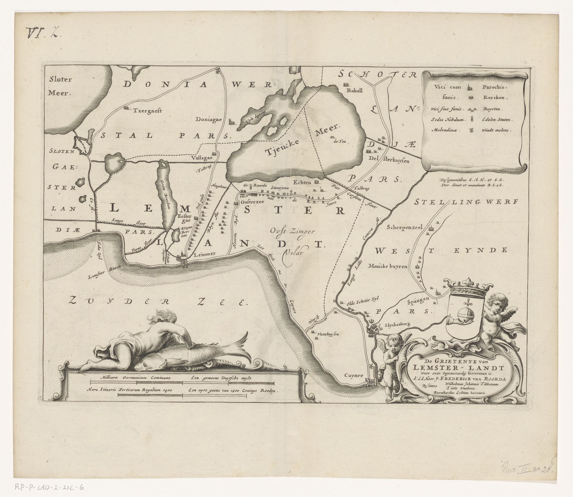
This is Jacob van Meurs's "Kaart van de grietenij Lemsterland", a map now held in the Rijksmuseum. Created in the 17th century, this isn't just a geographical document; it’s a window into the social and political landscape of the Dutch Republic. This map illustrates Lemsterland, a rural area in Friesland. Its creation coincides with a period of significant economic and cultural development known as the Dutch Golden Age. Yet, this prosperity was built on complex social hierarchies. Land ownership, as depicted in the map, was a key marker of power and status. The map also gives us a peek into the relationship between humans and the environment. The detailed depiction of waterways and land divisions reminds us of the ongoing struggle to manage water and land use. A constant negotiation that shaped the lives and livelihoods of the people living there. It’s a cartographic rendering of identity rooted in place and shaped by the ever-present sea.
Artwork details
- Medium
- print, engraving
- Dimensions
- height 227 mm, width 325 mm
- Location
- Rijksmuseum
- Copyright
- Rijks Museum: Open Domain
Tags
Comments
Share your thoughts
About this artwork
This is Jacob van Meurs's "Kaart van de grietenij Lemsterland", a map now held in the Rijksmuseum. Created in the 17th century, this isn't just a geographical document; it’s a window into the social and political landscape of the Dutch Republic. This map illustrates Lemsterland, a rural area in Friesland. Its creation coincides with a period of significant economic and cultural development known as the Dutch Golden Age. Yet, this prosperity was built on complex social hierarchies. Land ownership, as depicted in the map, was a key marker of power and status. The map also gives us a peek into the relationship between humans and the environment. The detailed depiction of waterways and land divisions reminds us of the ongoing struggle to manage water and land use. A constant negotiation that shaped the lives and livelihoods of the people living there. It’s a cartographic rendering of identity rooted in place and shaped by the ever-present sea.
Comments
Share your thoughts