1731 - 1740
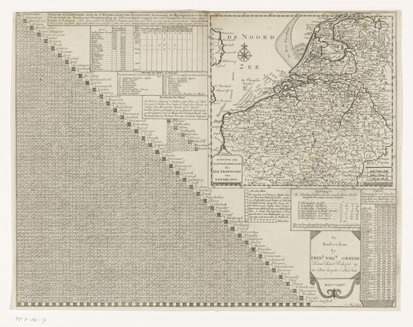
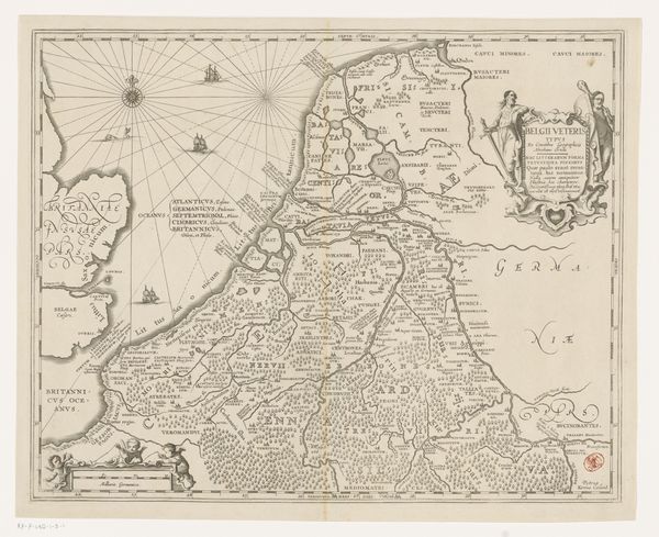
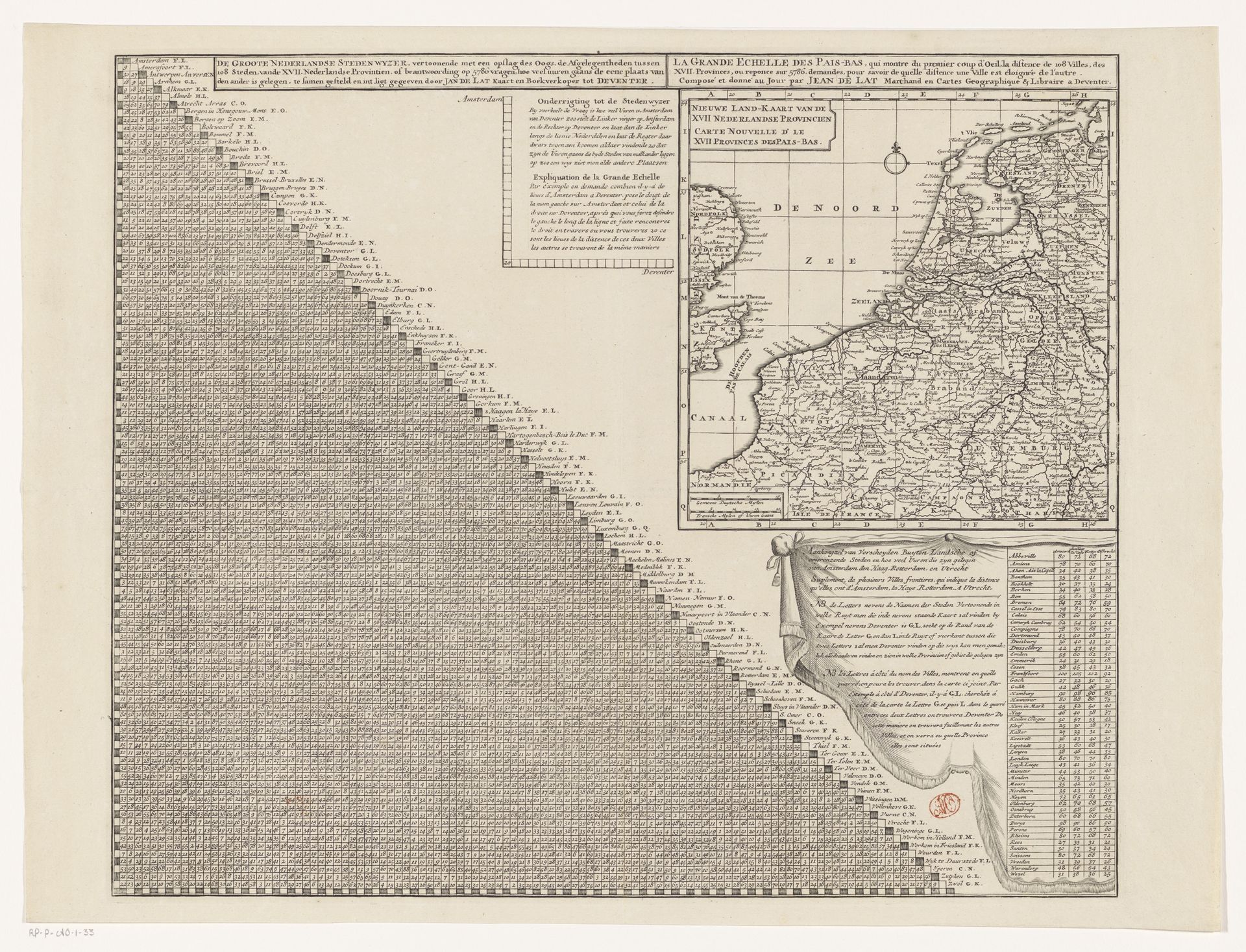
Kaart van de Zeventien Provinciën met afstandstabel
Listen to curator's interpretation
Curatorial notes
Editor: Here we have "Kaart van de Zeventien Provinciën met afstandstabel," a map of the Seventeen Provinces with a distance table, created between 1731 and 1740 by Jan de Lat. It's an engraving on paper, and it strikes me as incredibly detailed, almost obsessive in its precision. What symbolic weight would you say is carried within an object like this? Curator: Look closely at the triangle formed by the grid and names, it’s not merely a table, but a constructed social memory. Consider, the grid becomes a visual representation of relationships - distances - between locations. How do those distances influence ideas about trade routes, cultural exchanges and alliances between communities? Editor: That’s fascinating! The map itself seems pretty standard for the time, but the grid, like you said, dominates the composition. The cities appear in a pre-determined hierarchical ordering which has cultural meanings itself? Curator: Precisely! Think of the table as a system of shared knowledge and also control. This ‘distance table’ wasn’t just about measuring space, but reinforcing a very specific awareness of 'self' (one's city), and the “other,” meaning different places. Editor: So, the symbolic weight here is about understanding not just where places are, but how they relate, how they're different, and maybe even how they are placed within an inherited sociopolitical scheme? Curator: Exactly. It suggests the artist and his audience viewed these provinces as a network with coded relations, where each entity influences, relies, and contrasts with another. Can we assume these provinces see themselves within these distances too? What impact does that inherited perception have on us today? Editor: It makes me rethink maps. I always looked at them for geographic data, not emotional context or a shared visual culture in which a place is understood.