drawing, print, ink, engraving
#
drawing
#
baroque
# print
#
pen illustration
#
pen sketch
#
old engraving style
#
ink
#
history-painting
#
engraving
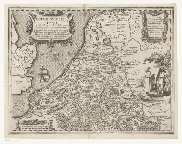
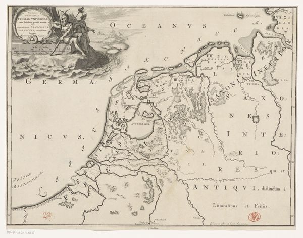
Dimensions: height 385 mm, width 485 mm
Copyright: Rijks Museum: Open Domain
Pieter van der Keere created this map of the Netherlands in Roman times sometime between 1571 and 1646. As we gaze at the rivers, forests, and settlements meticulously rendered, we are invited to consider how the land shapes identity and history. The map is a complex representation of power, knowledge, and cultural identity during the time it was made. It was created during a period of Dutch expansion and colonialism, and reveals the entanglement of cartography with the assertion of dominance over territories and peoples. It is a reminder that maps are never neutral; they reflect and reinforce specific worldviews and agendas. Van der Keere’s map invites us to contemplate the subjective nature of historical narratives. What stories are privileged, and whose perspectives are marginalized in the telling of history? As we reflect on this map of the Netherlands in Roman times, may we remain aware of how it reflects both the personal and the political.
Comments
No comments
Be the first to comment and join the conversation on the ultimate creative platform.
More like this