About this artwork
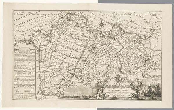
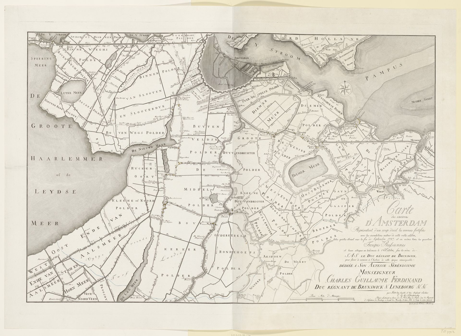
Editor: Here we have "Kaart van Amsterdam en de posities van de Pruisische troepen rondom de stad, 1787," a drawing printed around 1788-1789, by G. Tischbein. It depicts Amsterdam and its surroundings. It seems like such a precise document… almost cold. What do you see in this piece beyond just a historical record? Curator: I see a story of power, resistance, and shifting social landscapes embedded in these lines. This isn't simply a map; it's a representation of territorial control during a politically charged period. Consider the presence of Prussian troops: what does their positioning around Amsterdam signify? Think about the Patriot movement, seeking democratic reforms, and the Stadtholder's regime clinging to power. Editor: So, it's less about geography and more about politics? Curator: Exactly! Every line, every named "polder" or waterway, tells a story of ownership, access, and potentially, conflict. Who controlled these lands? How did this cartography reinforce existing power structures or, perhaps, challenge them? Maps were often used as tools of propaganda. Whose perspective is privileged in this image? How might those excluded from this representation have viewed it? Editor: That makes me see the drawing differently, not just as a depiction of a place but as a document shaping perception. Curator: Indeed. Consider, too, the visual language – the clean lines, the objective presentation. Does that neutrality truly exist? How does the act of mapping itself impose a particular order or narrative? What silences are present? Understanding these deeper narratives reveals a great deal about the socio-political context in which this map was created and consumed. Editor: This really shifts my thinking about what art, even seemingly technical drawings like this, can communicate. I will consider more deeply what stories the silences and inclusions can tell. Curator: Absolutely, and hopefully, the political environment that created the work. It's about looking beyond the surface to uncover the intricate layers of meaning embedded within the art object and context.
Kaart van Amsterdam en de posities van de Pruisische troepen rondom de stad, 1787 1788 - 1789
Artwork details
- Medium
- drawing, print, paper, ink, engraving
- Dimensions
- height 675 mm, width 985 mm
- Copyright
- Rijks Museum: Open Domain
Tags
drawing
dutch-golden-age
paper
ink
geometric
cityscape
engraving
Comments
No comments
About this artwork
Editor: Here we have "Kaart van Amsterdam en de posities van de Pruisische troepen rondom de stad, 1787," a drawing printed around 1788-1789, by G. Tischbein. It depicts Amsterdam and its surroundings. It seems like such a precise document… almost cold. What do you see in this piece beyond just a historical record? Curator: I see a story of power, resistance, and shifting social landscapes embedded in these lines. This isn't simply a map; it's a representation of territorial control during a politically charged period. Consider the presence of Prussian troops: what does their positioning around Amsterdam signify? Think about the Patriot movement, seeking democratic reforms, and the Stadtholder's regime clinging to power. Editor: So, it's less about geography and more about politics? Curator: Exactly! Every line, every named "polder" or waterway, tells a story of ownership, access, and potentially, conflict. Who controlled these lands? How did this cartography reinforce existing power structures or, perhaps, challenge them? Maps were often used as tools of propaganda. Whose perspective is privileged in this image? How might those excluded from this representation have viewed it? Editor: That makes me see the drawing differently, not just as a depiction of a place but as a document shaping perception. Curator: Indeed. Consider, too, the visual language – the clean lines, the objective presentation. Does that neutrality truly exist? How does the act of mapping itself impose a particular order or narrative? What silences are present? Understanding these deeper narratives reveals a great deal about the socio-political context in which this map was created and consumed. Editor: This really shifts my thinking about what art, even seemingly technical drawings like this, can communicate. I will consider more deeply what stories the silences and inclusions can tell. Curator: Absolutely, and hopefully, the political environment that created the work. It's about looking beyond the surface to uncover the intricate layers of meaning embedded within the art object and context.
Comments
No comments