print, engraving
baroque
landscape
engraving
Dimensions: height 587 mm, width 875 mm
Copyright: Rijks Museum: Open Domain
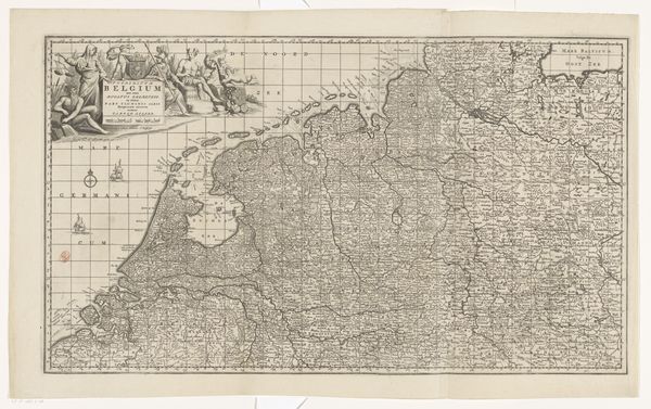
This map of Flanders and Holland was made by Charles Inselin around the turn of the 18th century, using engraving on paper. The image is made through careful incisions on a metal plate. The ink settles in these grooves, and is then transferred to the paper under great pressure, revealing intricate details of cities, rivers, and political boundaries. The physical qualities of the print – its crisp lines and tonal range – are entirely dependent on the skill of the engraver and the capacity of the press. Cartography at this time was a labor-intensive process and was tied to broader issues of trade and territorial power, which dictated who could afford to commission and consume such detailed maps. The act of mapping was, and remains, closely linked to the exercise of power. Ultimately, this object reminds us that even seemingly straightforward images involve skilled labor and reflect the economic and political realities of their time. It challenges us to consider the social context in which all art is produced.
Comments
No comments
Be the first to comment and join the conversation on the ultimate creative platform.