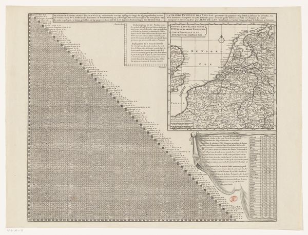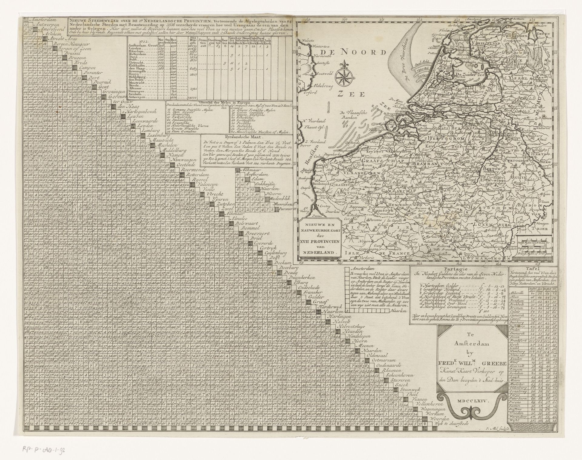
1764
Kaart van de Zeventien Provinciën met afstandstabel
Listen to curator's interpretation
Curatorial notes
Editor: This engraving, "Kaart van de Zeventien Provinciën met afstandstabel," by P. Mol, dating back to 1764, meticulously depicts a map alongside distance charts. I'm struck by how much detailed labor went into this kind of printmaking. What can you tell me about it? Curator: Absolutely. Focus on the materials and process here. It is printmaking: paper, ink, and an engraved metal plate are the essential ingredients, transformed through labor. How does this change the map, moving it from a representation to an object for display and dissemination? Editor: That's interesting, the material almost flattens the image. So, it isn't just about geography but about distributing this image... how did the print change the nature of accessing this information? Curator: Precisely. Maps prior to print remained exclusive. With the development of printing techniques, geographic knowledge began circulating within broader segments of society. The engraving facilitates mass production, making the geographical information accessible, consumable. Think about the labor involved not just in the artistic creation, but in its production and distribution. How did it operate within economic networks? Editor: I never considered that before. The scale and potential for mass distribution really democratizes the geographic data! Is the rise of the printing press also tied to Dutch Golden Age? Curator: Indeed. The Dutch Golden Age saw not only immense artistic output but also groundbreaking advancements in printing and publishing, which mutually benefited each other. Editor: So the materials and processes intertwined directly with larger cultural and economic shifts... I see it now. Curator: Yes, examining it through the lens of material and process makes this map so much more than just a depiction of land, and so much more about labour.