About this artwork
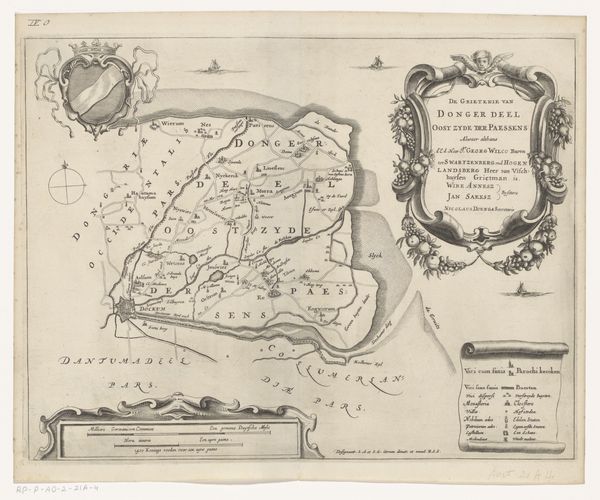
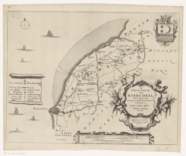
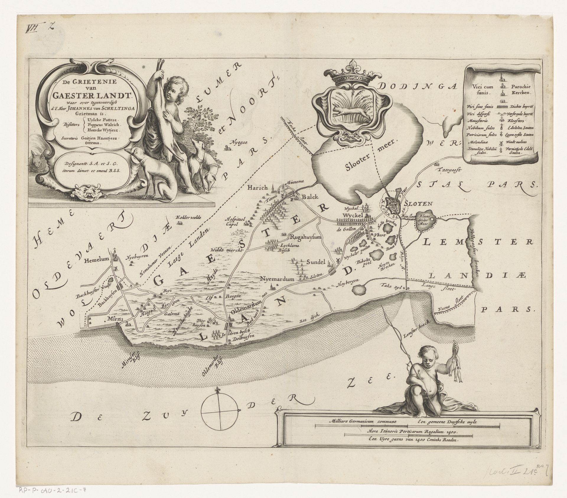
Editor: This is a map from 1664, "Kaart van de grietenij Gaasterland," by Jacob van Meurs, currently residing in the Rijksmuseum. It's a wonderfully detailed engraving. I’m struck by the cherubic figures nestled into the corners; they bring a touch of playful curiosity to what is essentially a geographical document. What stands out to you? Curator: You know, for me, these maps are always so much more than mere records of land. I see a narrative, a carefully constructed argument about power and possession. Think about it – the act of mapping is an act of claiming. How else can we, sitting here centuries later, “see” this place? I love how the engraver intertwines this declaration of ownership with, as you say, those wonderfully plump cherubs! Do you get a sense of what Gaasterland was staking claim to? Editor: Hmmm, well, I guess it’s declaring its boundaries, marking the towns and waterways… making a visual statement about its resources, perhaps? Curator: Precisely! And it's not just about resources. Notice the elaborate coat of arms. That’s about lineage, about history, about legitimacy. These maps were as much about who *should* rule as they were about what *they ruled*. Each carefully etched line is whispering a story. It’s easy to overlook such works, given their rather ‘technical’ focus but really… it’s about looking at the heart of a place at a given time. Editor: I never considered the politics embedded within something like a map. Curator: Maps are conversations; Jacob Van Meurs spoke clearly. Hopefully we all have. Editor: Definitely food for thought – thanks.
Artwork details
- Medium
- print, engraving
- Dimensions
- height 259 mm, width 342 mm
- Location
- Rijksmuseum
- Copyright
- Rijks Museum: Open Domain
Tags
Comments
Share your thoughts
About this artwork
Editor: This is a map from 1664, "Kaart van de grietenij Gaasterland," by Jacob van Meurs, currently residing in the Rijksmuseum. It's a wonderfully detailed engraving. I’m struck by the cherubic figures nestled into the corners; they bring a touch of playful curiosity to what is essentially a geographical document. What stands out to you? Curator: You know, for me, these maps are always so much more than mere records of land. I see a narrative, a carefully constructed argument about power and possession. Think about it – the act of mapping is an act of claiming. How else can we, sitting here centuries later, “see” this place? I love how the engraver intertwines this declaration of ownership with, as you say, those wonderfully plump cherubs! Do you get a sense of what Gaasterland was staking claim to? Editor: Hmmm, well, I guess it’s declaring its boundaries, marking the towns and waterways… making a visual statement about its resources, perhaps? Curator: Precisely! And it's not just about resources. Notice the elaborate coat of arms. That’s about lineage, about history, about legitimacy. These maps were as much about who *should* rule as they were about what *they ruled*. Each carefully etched line is whispering a story. It’s easy to overlook such works, given their rather ‘technical’ focus but really… it’s about looking at the heart of a place at a given time. Editor: I never considered the politics embedded within something like a map. Curator: Maps are conversations; Jacob Van Meurs spoke clearly. Hopefully we all have. Editor: Definitely food for thought – thanks.
Comments
Share your thoughts