graphic-art, print, engraving
#
graphic-art
#
dutch-golden-age
# print
#
landscape
#
engraving
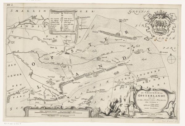
Dimensions: height 286 mm, width 374 mm
Copyright: Rijks Museum: Open Domain
This is a map of Achtkarspelen, made by Jacob van Meurs in the 17th century. It’s an etching, printed on paper. The lines are crisp and delicate, the product of a skilled hand using a sharp tool to incise an image into a metal plate. Consider the labor involved: not just the drafting of the map itself, but the preparation of the printing plate, the mixing of inks, and the operation of the printing press. Each stage would have required specialized knowledge and physical effort. Think, too, about the social context. Maps like these were essential tools for governance, commerce, and warfare. They represented a desire to understand and control territory, reflecting broader patterns of power and ownership. This wasn't just an image, it was an instrument. By appreciating the materials, the process, and the social context, we can move beyond a purely aesthetic reading of the map, and understand it as a product of its time, embedded in complex networks of labor, politics, and knowledge.
Comments
No comments
Be the first to comment and join the conversation on the ultimate creative platform.
More like this