print, etching, engraving
#
ink drawing
#
dutch-golden-age
# print
#
pen sketch
#
etching
#
cityscape
#
history-painting
#
engraving
Dimensions: height 428 mm, width 483 mm
Copyright: Rijks Museum: Open Domain
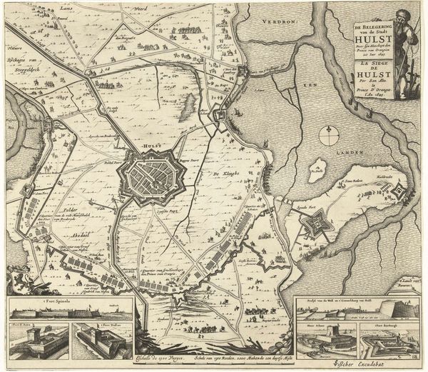
Salomon Savery created this print, "The Relief of Copenhagen, 1659," in the Netherlands, likely not long after the event it depicts. It shows the capital of Denmark after it had survived a siege by Sweden. But this isn’t just a factual record; it's a carefully constructed piece of propaganda. Visual codes within the image, such as the neat, orderly arrangement of buildings and the detailed fortifications, emphasize Dutch expertise in urban planning and military engineering. The print is more than a map; it’s a statement of power and prestige. To truly understand this print, we must consider the institutional history of cartography and printmaking in the Dutch Golden Age, when the Netherlands was a global leader in both fields. By studying these historical resources, we can better understand how images like this one contributed to the construction of national identity and the projection of power on the European stage.
Comments
No comments
Be the first to comment and join the conversation on the ultimate creative platform.
More like this