About this artwork
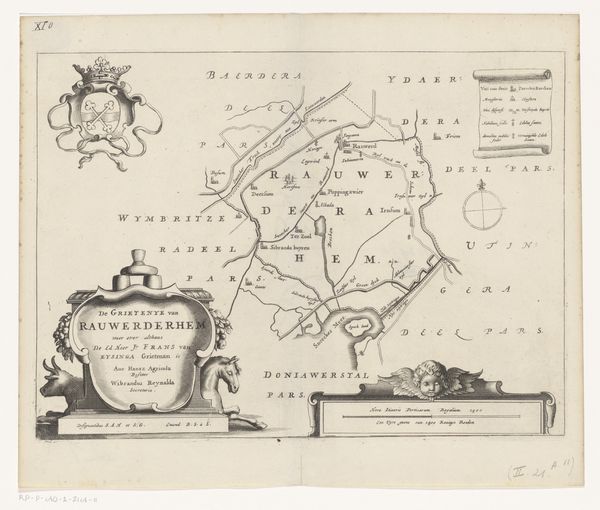
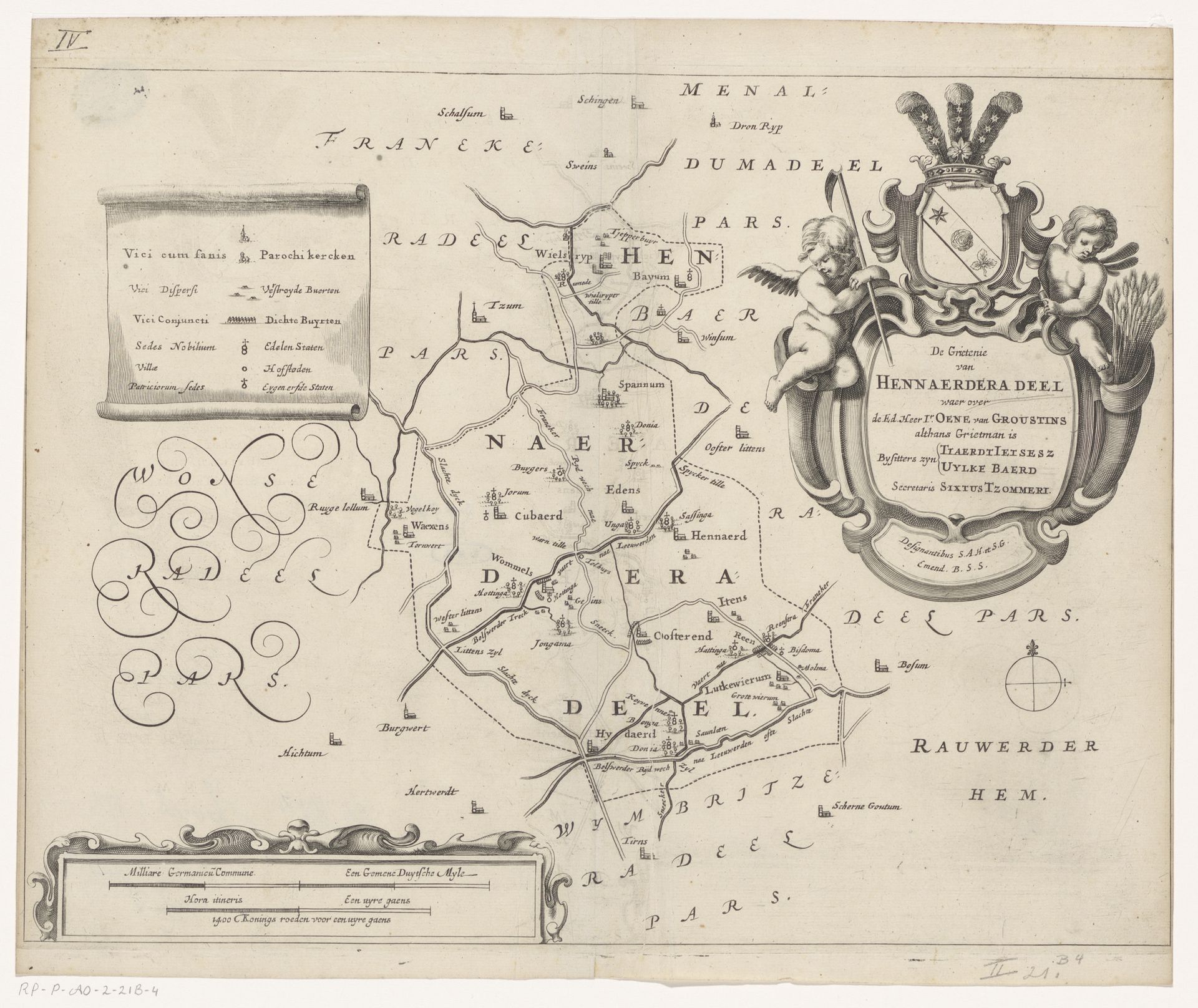
Editor: This engraving from 1664, "Kaart van de grietenij Hennaarderadeel," made by Jacob van Meurs and housed at the Rijksmuseum, presents a Dutch landscape. It's incredibly detailed, a bit like an aerial view almost. It feels quite formal, official. What catches your eye most in this work? Curator: Well, what I find compelling are the symbolic gestures embedded within what appears to be a straightforward cartographic document. Look at the cherubs flanking the coat of arms. These figures, common in Baroque art, often represent divine love or protection. How do you think their inclusion alters the reading of this map? Editor: I guess it adds a layer of… authorization? Almost like God sanctions this territory? Curator: Precisely. This is not just land; it is territory imbued with higher authority. Now, consider the wheat held by one cherub and the banner held by the other. Wheat traditionally symbolizes prosperity and fertility. And a banner can mean nobility and the right to wage war. Placed alongside the map, what narrative do these symbols weave? Editor: It suggests that this land is fertile, worth protecting, and that its rulers are divinely appointed and authorized to defend it. Curator: Indeed. Van Meurs is using symbols to assert a very specific understanding of power, prosperity, and divine right in this region. It’s a cultural shorthand, easily understood by his contemporary audience. Does seeing these familiar symbols help us today? Editor: Yes, absolutely. Recognizing them highlights the importance of interpreting maps not just as geographical tools, but as cultural artifacts reflecting the beliefs and power structures of their time. Thank you. Curator: My pleasure, reflecting upon these continuities certainly reshapes my views as well.
Artwork details
- Medium
- graphic-art, print, ink, engraving
- Dimensions
- height 282 mm, width 368 mm
- Location
- Rijksmuseum
- Copyright
- Rijks Museum: Open Domain
Tags
graphic-art
baroque
dutch-golden-age
ink
engraving
Comments
No comments
About this artwork
Editor: This engraving from 1664, "Kaart van de grietenij Hennaarderadeel," made by Jacob van Meurs and housed at the Rijksmuseum, presents a Dutch landscape. It's incredibly detailed, a bit like an aerial view almost. It feels quite formal, official. What catches your eye most in this work? Curator: Well, what I find compelling are the symbolic gestures embedded within what appears to be a straightforward cartographic document. Look at the cherubs flanking the coat of arms. These figures, common in Baroque art, often represent divine love or protection. How do you think their inclusion alters the reading of this map? Editor: I guess it adds a layer of… authorization? Almost like God sanctions this territory? Curator: Precisely. This is not just land; it is territory imbued with higher authority. Now, consider the wheat held by one cherub and the banner held by the other. Wheat traditionally symbolizes prosperity and fertility. And a banner can mean nobility and the right to wage war. Placed alongside the map, what narrative do these symbols weave? Editor: It suggests that this land is fertile, worth protecting, and that its rulers are divinely appointed and authorized to defend it. Curator: Indeed. Van Meurs is using symbols to assert a very specific understanding of power, prosperity, and divine right in this region. It’s a cultural shorthand, easily understood by his contemporary audience. Does seeing these familiar symbols help us today? Editor: Yes, absolutely. Recognizing them highlights the importance of interpreting maps not just as geographical tools, but as cultural artifacts reflecting the beliefs and power structures of their time. Thank you. Curator: My pleasure, reflecting upon these continuities certainly reshapes my views as well.
Comments
No comments