drawing, print, paper, ink, engraving
#
drawing
#
dutch-golden-age
# print
#
old engraving style
#
landscape
#
paper
#
ink
#
engraving
Dimensions: height 290 mm, width 370 mm
Copyright: Rijks Museum: Open Domain
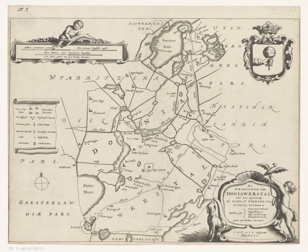
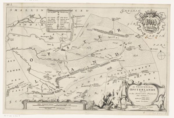
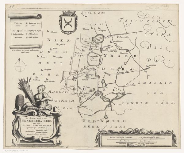
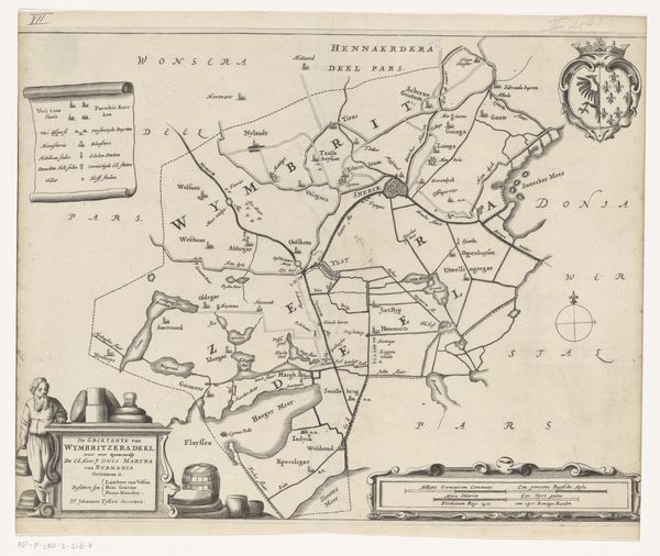
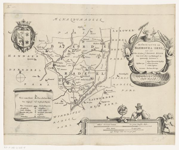
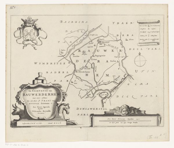
Jacob van Meurs made this map of Utingeradeel in the Netherlands in the mid-17th century. Its formal features locate it within a rich history of Dutch cartography. But maps are never neutral. Note the prominent coat-of-arms, along with the dedication to the local administrator Andringa. The inclusion of such heraldry indicates that the map served as a symbol of power and authority, reinforcing the social hierarchy of the time. We can also see this in the geographical features which show us the importance of land ownership and control in Dutch society. Looking at the map’s visual codes and cultural references helps us understand its role as a tool for shaping perceptions of territory and identity. By researching archives and historical records, we can uncover the complex social relations embedded within this seemingly objective representation of space.
Comments
No comments
Be the first to comment and join the conversation on the ultimate creative platform.
More like this