About this artwork
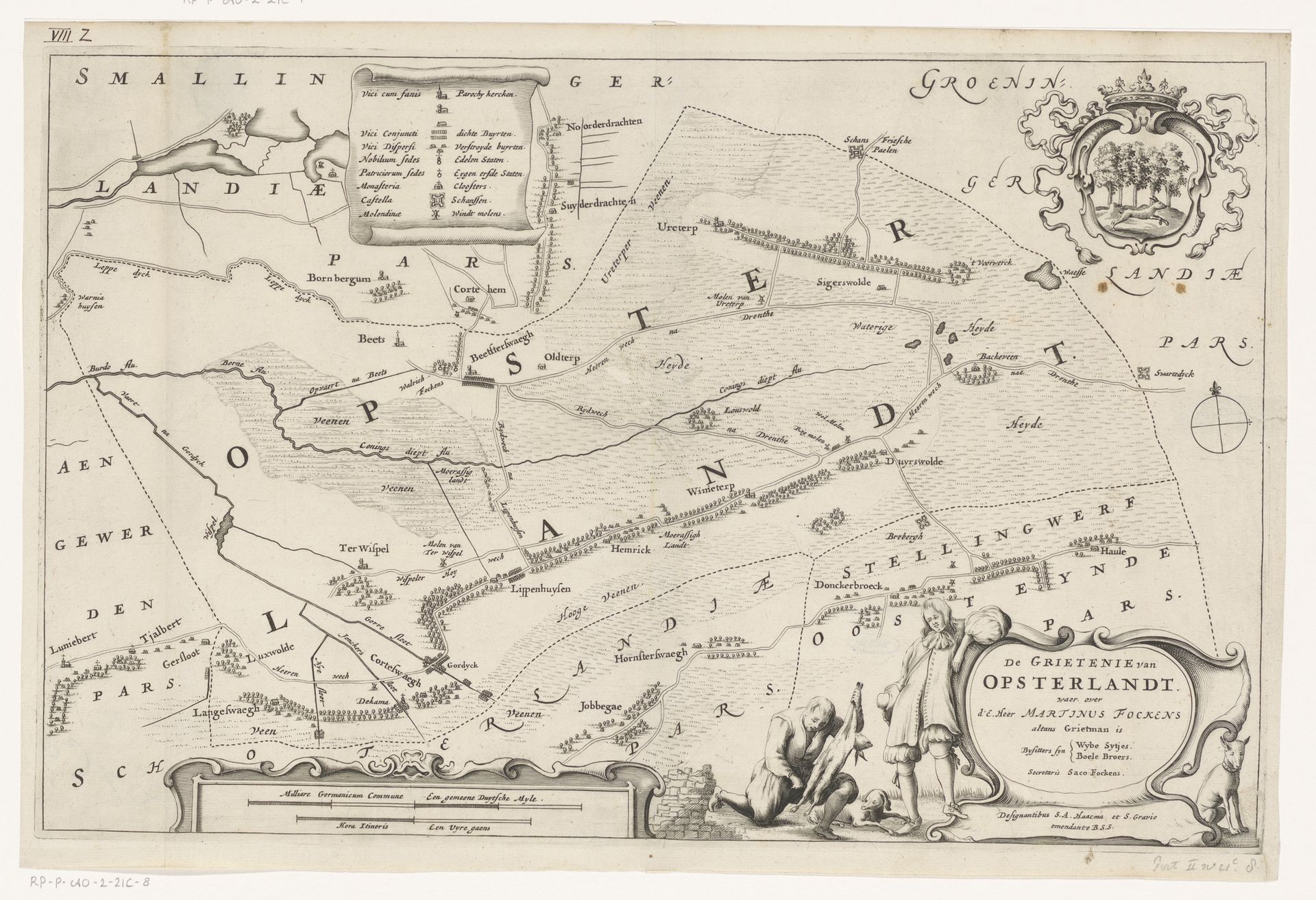
Curator: We're looking at "Kaart van de grietenij Opsterland," a map of Opsterland created in 1664 by Jacob van Meurs, currently held in the Rijksmuseum. Editor: Immediately, the visual clarity and detail impress me. The intricate lines defining the landscape have a delicate balance and formal quality. Curator: Indeed, it is a wonderful example of Dutch Golden Age cartography. It gives insight into the administrative divisions and land use during that period. We can interpret that in tandem with how these areas have been subjected to a host of geopolitical implications. Editor: I am drawn to the cartouches and the small figures along the bottom; it feels ornamental rather than purely functional, stylistically very baroque. The texture of the engraving and the contrasts contribute to its legibility but also a specific aesthetic impact. Curator: Precisely! These details weren't merely aesthetic, these figures and emblems spoke to Opsterland's perceived character and projected power. What does the very inclusion of this territory in atlases of the time say about the increasing centralization and formalization of the Netherlands? Editor: I suppose what captivates me, at a purely sensory level, is how it merges technical draftsmanship with almost calligraphic artistry; the letters curve along the rivers. Curator: Mapping served a clear role within society, aiding in governance and trade. One could spend hours locating particular farms, settlements, waterways, and understanding Opsterland's contribution to the political life and administrative structure of its time. Editor: For me, this map succeeds so well because of how the varying lines interplay; you could even see a rhythm in their placement—a visual cadence. Curator: Thinking about its audience and circulation shifts how we value it, then, from merely appreciating its texture to uncovering how it molded and mediated views of a place at a particular historical juncture. Editor: Perhaps we both find common ground in observing that this "map" reflects so much more than physical space; it embodies knowledge, aspiration, and, yes, power itself.
Artwork details
- Medium
- print, engraving
- Dimensions
- height 290 mm, width 445 mm
- Location
- Rijksmuseum
- Copyright
- Rijks Museum: Open Domain
Tags
baroque
dutch-golden-age
landscape
history-painting
engraving
Comments
No comments
About this artwork
Curator: We're looking at "Kaart van de grietenij Opsterland," a map of Opsterland created in 1664 by Jacob van Meurs, currently held in the Rijksmuseum. Editor: Immediately, the visual clarity and detail impress me. The intricate lines defining the landscape have a delicate balance and formal quality. Curator: Indeed, it is a wonderful example of Dutch Golden Age cartography. It gives insight into the administrative divisions and land use during that period. We can interpret that in tandem with how these areas have been subjected to a host of geopolitical implications. Editor: I am drawn to the cartouches and the small figures along the bottom; it feels ornamental rather than purely functional, stylistically very baroque. The texture of the engraving and the contrasts contribute to its legibility but also a specific aesthetic impact. Curator: Precisely! These details weren't merely aesthetic, these figures and emblems spoke to Opsterland's perceived character and projected power. What does the very inclusion of this territory in atlases of the time say about the increasing centralization and formalization of the Netherlands? Editor: I suppose what captivates me, at a purely sensory level, is how it merges technical draftsmanship with almost calligraphic artistry; the letters curve along the rivers. Curator: Mapping served a clear role within society, aiding in governance and trade. One could spend hours locating particular farms, settlements, waterways, and understanding Opsterland's contribution to the political life and administrative structure of its time. Editor: For me, this map succeeds so well because of how the varying lines interplay; you could even see a rhythm in their placement—a visual cadence. Curator: Thinking about its audience and circulation shifts how we value it, then, from merely appreciating its texture to uncovering how it molded and mediated views of a place at a particular historical juncture. Editor: Perhaps we both find common ground in observing that this "map" reflects so much more than physical space; it embodies knowledge, aspiration, and, yes, power itself.
Comments
No comments