drawing, print, etching, paper, ink
drawing
dutch-golden-age
etching
landscape
paper
ink
geometric
Dimensions: height 285 mm, width 362 mm
Copyright: Rijks Museum: Open Domain
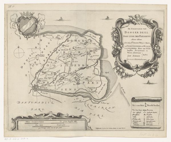
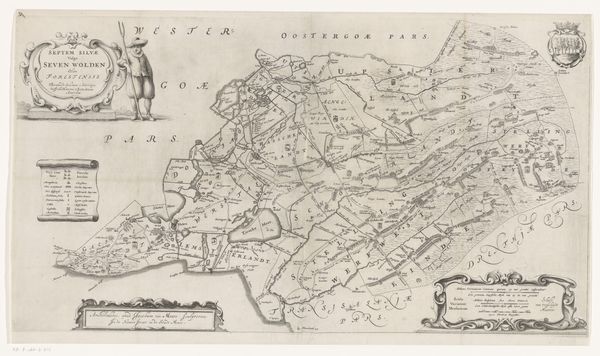
Jacob van Meurs made this map of Hemelumer Oldephaert en Noordwolde some time in the 17th century. It’s an etching that describes in great detail the countryside of what we now call the province of Friesland in the Netherlands. This image gives us a glimpse into the way the Dutch understood their relationship to the land and water around them. As you can see, the towns are named, and the waterways are carefully demarcated, suggesting a culture deeply engaged with its natural environment. Maps like these were produced during the Dutch Golden Age, a period of intense economic and artistic development. The detailed craftsmanship and the inclusion of symbolic elements reflect the cultural values of the time. The coat of arms and the cherubic figures are visual cues that would have resonated with the elite society that consumed these images. By studying archival records, we can better understand the mapmaker's intentions and the impact of this kind of imagery on the society of its time.
Comments
No comments
Be the first to comment and join the conversation on the ultimate creative platform.