drawing, print, ink, engraving
#
drawing
#
baroque
#
pen drawing
# print
#
ink
#
geometric
#
cityscape
#
engraving
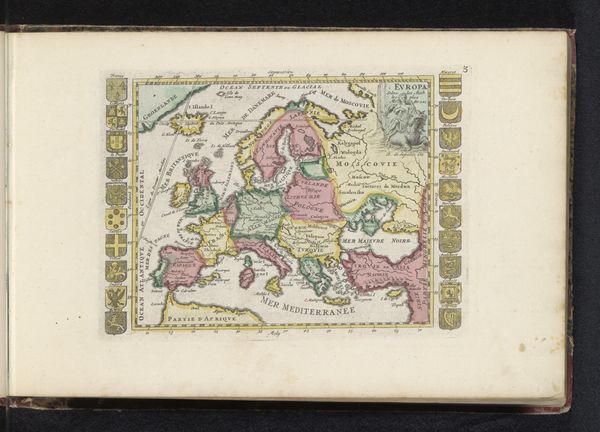
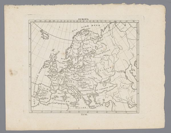
Dimensions: height 229 mm, width 304 mm
Copyright: Rijks Museum: Open Domain
This anonymous map of Europe is an engraving on paper. While the artist is unknown, its creation reflects Europe’s evolving self-perception. Consider the complex power dynamics inherent in map-making. Cartography has historically been a tool of colonialism and control. This map, meticulously detailing European territories, subtly reinforces a Eurocentric view of the world. What is included? What is left out? These questions of representation shape perceptions of identity and power. Reflect on the emotional weight carried by maps: they define territories, legitimize claims, and shape our understanding of belonging. This map is a mirror reflecting not just geography, but also the shifting sands of identity, power, and perception.
Comments
No comments
Be the first to comment and join the conversation on the ultimate creative platform.
More like this