About this artwork
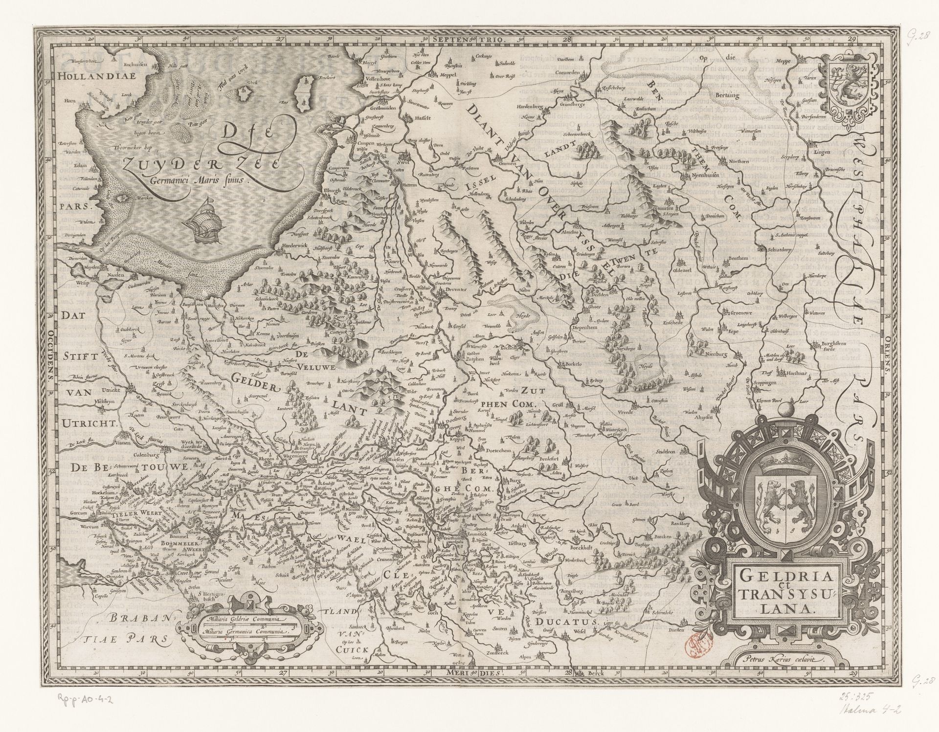
This is an engraving of Gelderland and Overijssel, made by Pieter van der Keere around the turn of the 17th century. The image creates meaning through both visual codes and historical associations. This map wasn't just a tool for navigation, but a statement of power. It reflects the cultural and political landscape of the Netherlands at a time when cartography was becoming increasingly sophisticated. Note the careful detail in the depiction of cities, rivers, and regional boundaries. This map emerged during the rise of Dutch maritime power and commercial expansion. Institutions such as the Dutch East India Company relied on accurate maps for their operations, so cartographers like Van der Keere played a vital role in shaping this era. To fully understand this work, we might consult archives and libraries for period documents, maps, and other visual records. Art, like this map, isn't just about aesthetics; it's a window into the social, economic, and institutional contexts of its time.
Kaart van Gelderland en Overijssel
1617 - 1622
Pieter van der Keere
1571 - 1646Location
RijksmuseumArtwork details
- Medium
- print, engraving
- Dimensions
- height 377 mm, width 491 mm
- Location
- Rijksmuseum
- Copyright
- Rijks Museum: Open Domain
Tags
Comments
Share your thoughts
About this artwork
This is an engraving of Gelderland and Overijssel, made by Pieter van der Keere around the turn of the 17th century. The image creates meaning through both visual codes and historical associations. This map wasn't just a tool for navigation, but a statement of power. It reflects the cultural and political landscape of the Netherlands at a time when cartography was becoming increasingly sophisticated. Note the careful detail in the depiction of cities, rivers, and regional boundaries. This map emerged during the rise of Dutch maritime power and commercial expansion. Institutions such as the Dutch East India Company relied on accurate maps for their operations, so cartographers like Van der Keere played a vital role in shaping this era. To fully understand this work, we might consult archives and libraries for period documents, maps, and other visual records. Art, like this map, isn't just about aesthetics; it's a window into the social, economic, and institutional contexts of its time.
Comments
Share your thoughts