graphic-art, print, paper, engraving
#
graphic-art
# print
#
old engraving style
#
landscape
#
paper
#
geometric
#
line
#
history-painting
#
academic-art
#
engraving
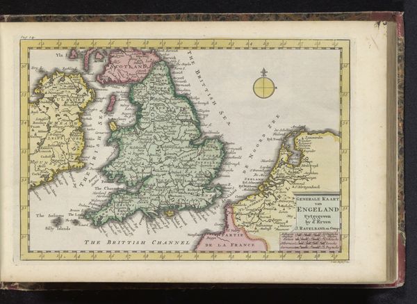
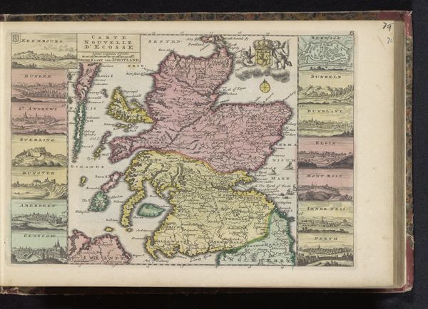
Dimensions: height 232 mm, width 302 mm
Copyright: Rijks Museum: Open Domain
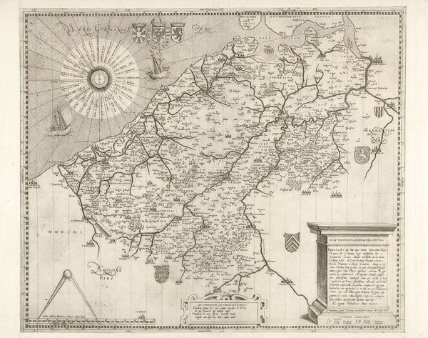
Editor: This print, titled "Kaart van Engeland, 1726," is an engraving on paper, made in 1726 by an anonymous artist. Looking at all these detailed lines, I wonder, how much can one unpack by purely focusing on the composition itself? What do you see in this piece from a formal perspective? Curator: Indeed, it's quite intricate. Let's consider the use of line. Notice how the artist employs varying thicknesses to delineate geographical boundaries, differentiate between land and water. The overall effect is one of texture and depth, achieved solely through manipulation of line. Do you observe a hierarchy in the linework, suggesting areas of emphasis? Editor: I do. The heavier lines definitely trace the coastline, giving England a very distinct shape against the negative space of the sea. And inland, thinner lines form a complex network representing rivers and perhaps regional boundaries. Curator: Precisely. The density of these inland lines contributes to a sense of detailed topography. Also, consider the decorative elements in the upper-right corner – the figures, animals, and cartouche. How do these elements interact formally with the map itself? Editor: Well, they're contained within a defined area, almost like a separate composition interacting with the geographical representation. The figures introduce a narrative element. It is a different kind of symbol, unlike the topography. Curator: Exactly. One could even argue that this combination of representational and symbolic elements creates a tension within the work. Do you see how the very nature of these formal decisions dictates our reading? Editor: That makes so much sense! I never thought to analyze a map in terms of line weight, texture, or symbolic additions before. Thinking about art as a composition first, then history. I'll carry that lesson with me. Curator: Yes, looking closer into composition and shapes might open completely different and unknown approaches for understanding what an artwork is conveying.
Comments
No comments
Be the first to comment and join the conversation on the ultimate creative platform.
More like this