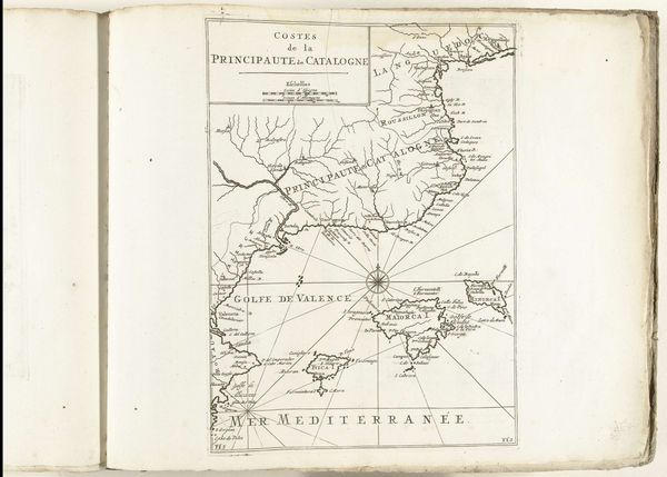
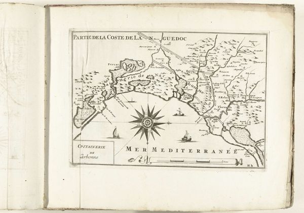
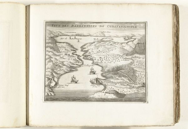
drawing, print, ink, engraving
#
drawing
#
baroque
# print
#
landscape
#
ink
#
engraving
Dimensions: height 228 mm, width 330 mm
Copyright: Rijks Museum: Open Domain
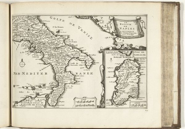
Curator: Let us consider this print, held at the Rijksmuseum, entitled "Kaart van de Franse zuidkust bij Marseille, 1726," dating, unsurprisingly, to 1726. Editor: Well, first blush, I see a kind of constrained romanticism. All these lines, you know, attempting order, but the sea—it remains this turbulent scribble outside of our imposed logic. It reminds me of being seasick on vacation! Curator: Indeed, the structure presents a fascinating dichotomy. We have the formal rendering of cartography—precise linework delineating the coastline—juxtaposed with more representational elements, particularly the topographic shading suggesting the region's elevations and settlements. It's as much an artistic object as it is a functional document. Editor: Functional is one way to put it. I’m caught by this compass rose in the lower left, such a dominant gesture, and then that cartouche just kind of… laying on the bottom. Is that flourish necessary, I ask you? Are we mapping the world or trying to pretty it? Curator: Consider that ornamentation an index of its time; a cultural marker gesturing towards the Baroque. We can consider the compass a semiotic representation, of course, with layers of structural symbolism and directional logic, providing multiple readings. Editor: Fine, layers of structural symbolism… But honestly, my eye keeps snagging on the weirdness of "Mer de Berre.” Just sounds funny, you know? All these little visual factoids clustered on top, then a body of water called "Mer de Berre." It just strikes a chord of silliness, or irreverence maybe? It breaks through the otherwise dignified formality. Curator: I would argue, that these perceived… eccentricities, are inherent properties of a historically grounded aesthetic object that allow us to locate the engraving within an expanded understanding of mapping convention in 18th century France. Its visual and semantic composition generates meaning specific to both its temporal and geographical origin. Editor: So much for seasickness! I still get that weird constrained beauty. Maybe it's because order's so damned impossible. You try, you fail, you get this kind of controlled chaos. Curator: Indeed. And I must admit your reflections offer an affective response that mere analysis often misses.
Comments
No comments
Be the first to comment and join the conversation on the ultimate creative platform.
More like this