drawing, print, engraving
#
drawing
#
baroque
#
pen drawing
# print
#
landscape
#
geometric
#
engraving
Dimensions: height 355 mm, width 474 mm
Copyright: Rijks Museum: Open Domain
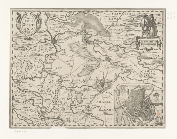
This is a map of Zeeland, created by an anonymous artist, a fascinating representation of land and sea rendered with meticulous detail. Note the compass rose, a symbol laden with meaning. Rooted in ancient navigation, it transcends mere direction, acting as a potent emblem of exploration, destiny, and the human quest for understanding our place in the world. Think of its earlier iterations: the wind roses in medieval portolan charts, guiding sailors across uncharted waters, each point a whispered promise of safe passage. The compass rose appears throughout art history, from maps to decorative motifs, evolving yet retaining its core essence: the lure of the unknown, the call to adventure. It echoes in the subconscious, a reminder of our inherent drive to navigate life's complexities, both internal and external. It is an enduring symbol, continually resurfacing, a testament to our timeless pursuit of knowledge and orientation in an ever-shifting world.
Comments
No comments
Be the first to comment and join the conversation on the ultimate creative platform.
More like this