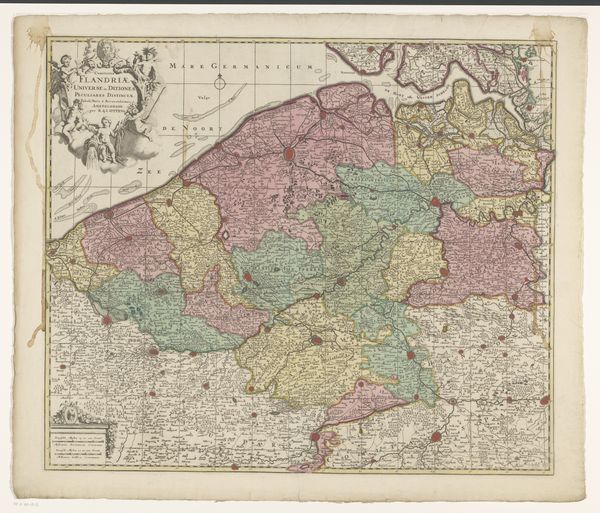
graphic-art, print, engraving
graphic-art
baroque
dutch-golden-age
landscape
engraving
Dimensions: height 495 mm, width 583 mm
Copyright: Rijks Museum: Open Domain
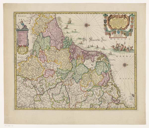
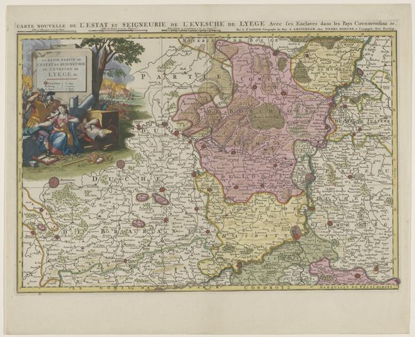
Curator: Immediately, the intricacy impresses. The density of detail is remarkable; I'm drawn in. Editor: Indeed! What we're looking at here is a pre-1700 engraving known as "Kaart van de Zeventien Provinciën," or Map of the Seventeen Provinces, by Gerard Valck, currently held in the Rijksmuseum's collection. It exemplifies the Dutch Golden Age's cartographic prowess. Curator: Precisely. Observe how the line work defines not just geographical boundaries but also texture and relief. Notice, too, the Baroque influence, a dynamic energy captured through elaborate ornamentation and figurative elements, which disrupts the potential monotony of purely functional mapmaking. Editor: It's a product of its time; these embellishments aren't just decoration. Cartography held significant political and economic weight in the 17th century. The detailed depiction of cities, waterways, and trade routes served to solidify Dutch power and project authority, even incorporating classicized allegorical figures within the ornamental title cartouche to further enhance the sense of national grandeur. Curator: I see that, though I can't ignore how the colors – subtle though they are – establish zones, structuring the composition while simultaneously delineating the provinces from one another. It provides both order and clarity, but is the coloring accurate or idealized, a deliberate construct to shape perception? Editor: Accuracy in maps from this era can be rather flexible, molded by political priorities, though it is not meant to fully deviate from its intended geographic portrayal. Its role lies not merely in truthful documentation, but in visualizing aspirations of control, trade, and cultural relevance for the Dutch Republic on the international stage. Valck’s artistry contributes greatly in cementing such political and cultural relevance. Curator: True, and Valck uses formal choices, specifically with coloration and figuration, to contribute a unique lens that transforms data into propaganda. In observing and appreciating, this shifts my analysis of what truth really constitutes. Editor: A valuable observation. Looking at the piece through both lenses provides richer insight to how societal impact influences artistic interpretations, past and present.
Comments
No comments
Be the first to comment and join the conversation on the ultimate creative platform.