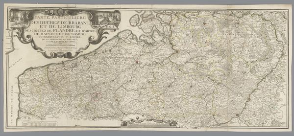
drawing, print, etching, pen
#
drawing
# print
#
etching
#
landscape
#
coloured pencil
#
folk-art
#
pen
Dimensions: height 159 mm, width 221 mm
Copyright: Rijks Museum: Open Domain
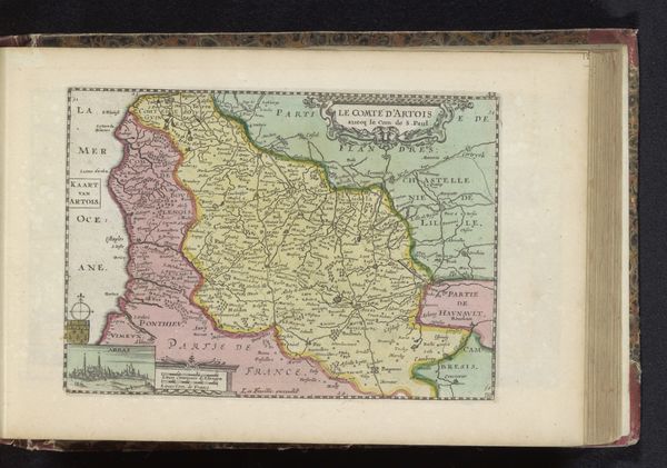
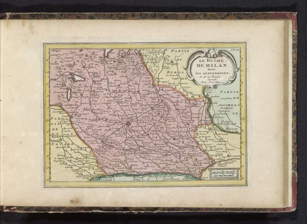
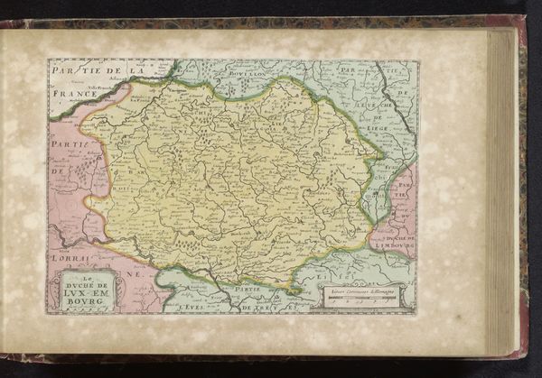
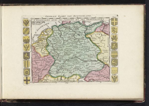
Curator: Ah, a map. There's something so romantic and yearning about them, don't you think? The anticipation of adventure, all held within those lines. Editor: Right. I'd say this map of West-Flanders, dating to around 1700 to 1735, by an anonymous artist, presents more than just geographic boundaries. The print with etching and pen shows how geographical knowledge at the time demanded artisanal and technological investment. Curator: It almost feels... homemade, which I love. It's got this endearing roughness around the edges. You can almost smell the ink, the parchment, the hand that painstakingly added each name and river. What I find fascinating is what they chose to highlight. Where were the artists priorities? Editor: True, and its charm also lies in understanding how it was created. These weren't mass-produced. Each etching required skill, time and labor and we could argue, like early industrial techniques. Look at the materials – paper, ink, metal plate. Not easily acquired at the time, not for everyone. Curator: Absolutely. It makes you wonder about the workshops. About who did what and where the final copies ended up. This speaks to the value and use of land and property; this knowledge could inform property or strategic planning. It makes one curious, about what happened during that period. You think about what was left OUT, right? It speaks volumes, doesn't it? It gives so much food for thought! Editor: Exactly. Who were its intended audience, and what kind of influence did a "hand-made" cartographic material like this have? Even the folk-art style—its deliberate presentation—suggests particular interests or functions. Also the coloured pencil adds detail to boundaries, showing trade routes and marking territories which could have involved consumption of luxury pigments. Curator: And what kind of creative agency did the anonymous creator(s) of this map actually have? And it leaves me with the question what kind of journeys those colours saw on their own! Editor: Right. When we consider how knowledge and artisanal skills combined to create this kind of map, and its physical impact across that region we question the common understanding about boundaries of "high art".
Comments
No comments
Be the first to comment and join the conversation on the ultimate creative platform.
More like this