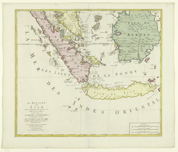
print, etching, engraving
#
aged paper
#
light pencil work
# print
#
etching
#
old engraving style
#
landscape
#
etching
#
orientalism
#
natural palette
#
engraving
#
realism
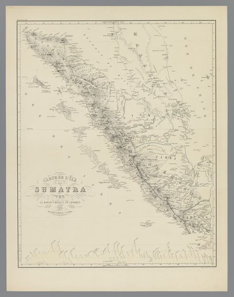
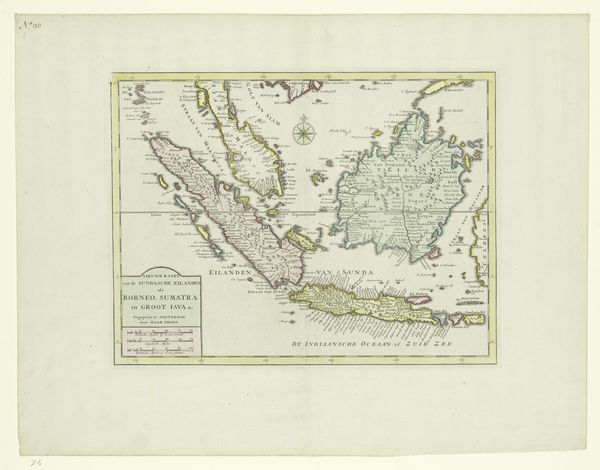
Dimensions: height 556 mm, width 404 mm
Copyright: Rijks Museum: Open Domain
This is Desiré Heyse's "Map of Sumatra." The map reflects the evolving colonial interests of the Netherlands in the East Indies during the 19th century. Consider the political and economic implications of such a detailed rendering. Mapping was not just a scientific endeavor; it was an act of claiming territory and resources. What does it mean to survey and demarcate a land already inhabited? The visual language of maps—the lines, the colors, the naming of places—asserts a particular kind of power. It gives the mapmaker, and by extension the colonizing power, a sense of authority and control. Analyzing the map involves understanding the history of Dutch colonialism, the role of the Dutch East India Company, and the resistance of the Sumatran people. Old administrative reports, travelogues, and indigenous accounts can help us understand this map. The meaning of art is always shaped by its social and institutional context.
Comments
No comments
Be the first to comment and join the conversation on the ultimate creative platform.
More like this