graphic-art, print, etching, engraving
#
graphic-art
#
dutch-golden-age
# print
#
etching
#
landscape
#
etching
#
engraving
Dimensions: height 284 mm, width 372 mm
Copyright: Rijks Museum: Open Domain
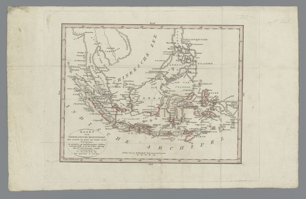
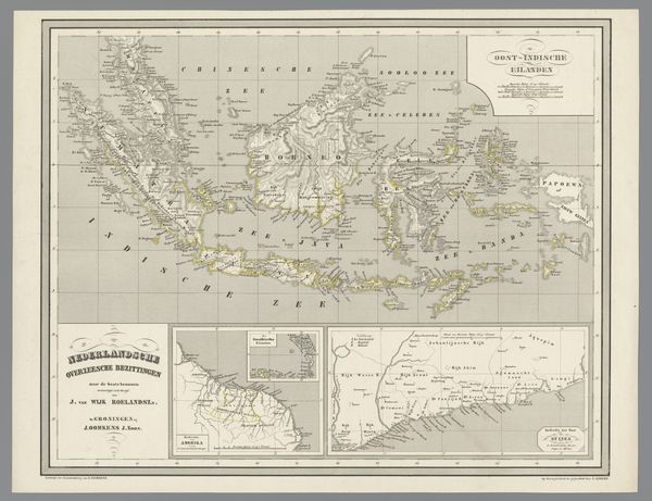
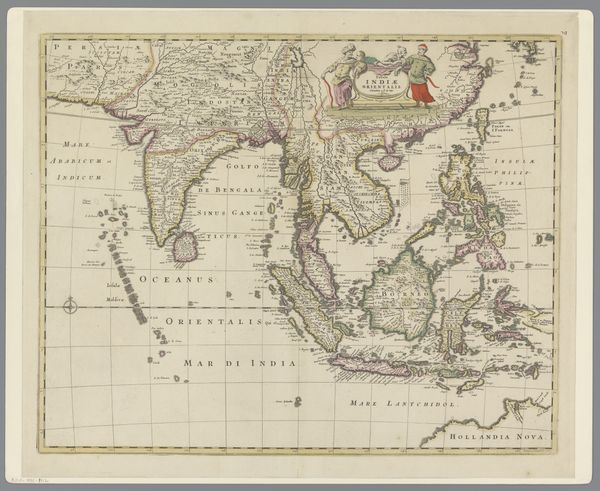
Curator: This etching before us is entitled "Kaart van de Indonesische archipel," created by Isaak Tirion in 1744. Editor: Wow, it looks like a watercolour painting! The coastlines are very delicate, with muted yellows, pinks and greens… There’s something so charming and almost fantastical about maps like these, you know? Makes you wonder what people back then imagined what was there. Curator: Absolutely, these maps offer insights into the worldview of the Dutch Golden Age, illustrating not only geographical knowledge but also the ambitions and interests of the Dutch East India Company. They constructed these images as much for administrative use as to signify their claim of dominion. The "unknown" parts of the region, that's a sort of symbolism as well, a cultural and economic absence or tabula rasa as the Company might prefer to think of it. Editor: It makes you think about stories, almost like imagined travels of traders and adventures. Like some kind of half-real legend! The ships battling terrible seas to reach those far off lands. I guess, thinking about it more, a colonial power would probably look at this and be calculating logistics, materials… or the acquisition of these materials from another place that may or may not agree. Sorry… I just killed the buzz of that earlier imagining. Curator: You didn’t kill it, you gave it depth. That’s how we must see these documents now. These weren’t merely observations of topography, these kinds of landscapes actively promoted colonial agendas. They served as both a scientific instrument and an ideological symbol. We must not forget this print acted as a tool in asserting Dutch power across the Indonesian archipelago, rationalising the plundering of natural resources. Editor: So a nice painting wasn’t always just a nice painting…it's tied into larger systems. It's difficult, seeing such attractive pictures but knowing that those were some serious businesses going on at the time… So interesting and complicated. Curator: It is, isn't it? It's vital to keep this historical complexity in mind when we view pieces like this one today. It encourages conversation and thought.
Comments
No comments
Be the first to comment and join the conversation on the ultimate creative platform.
More like this