drawing, print, paper, ink
#
drawing
#
dutch-golden-age
# print
#
landscape
#
paper
#
ink
#
coloured pencil
#
cityscape
#
genre-painting
Dimensions: height 156 mm, width 230 mm
Copyright: Rijks Museum: Open Domain
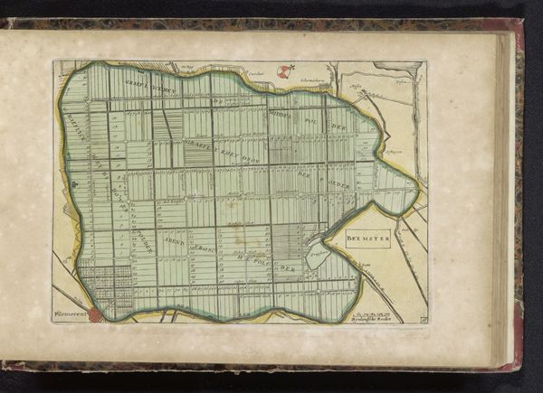
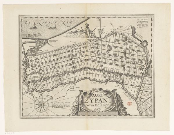
This is an anonymous map of the polder Zijpe, probably made in the Netherlands sometime after the land was reclaimed in 1597. The map depicts a landscape remade through human ingenuity, wrested from the sea. It speaks to the growing power of technology and engineering to transform the natural world. The strict grid pattern reflects a new social order imposed on the land, replacing the messy chaos of nature with rational divisions. Each plot signifies ownership and control. We might consider this map as a form of propaganda. It celebrates Dutch ingenuity and the power of human will. The visual codes present an idealized vision of progress. When interpreting this map, we can consult historical archives, engineering reports, and legal documents related to land reclamation. These sources help us understand the social, economic, and political context in which it was made. Maps are not neutral records but reflect the values and aspirations of those who create them.
Comments
No comments
Be the first to comment and join the conversation on the ultimate creative platform.
More like this