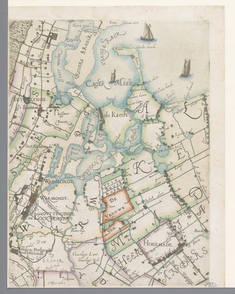
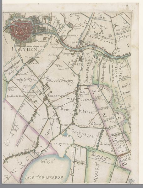
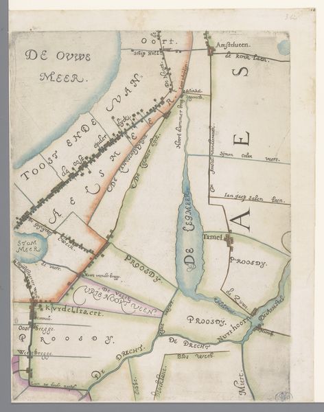
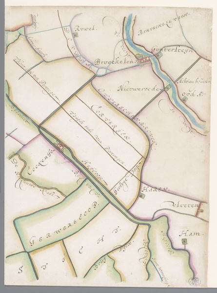
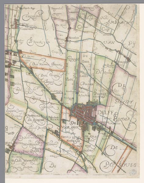
Deel van een kaart van het Hoogheemraadschap van Rijnland, met Montfoort en Oudewater 1615
0:00
0:00
florisbalthasarszvanberckenrode
Rijksmuseum
print, engraving
#
dutch-golden-age
# print
#
landscape
#
engraving
#
realism
Dimensions: height 371 mm, width 273 mm
Copyright: Rijks Museum: Open Domain
Curator: So, we're looking at "Deel van een kaart van het Hoogheemraadschap van Rijnland, met Montfoort en Oudewater," a section of a map made in 1615 by Floris Balthasarsz van Berckenrode. It’s an engraving, a print showcasing the Rijnland region. Editor: It has the soft, muted colours of an old storybook—the kind you'd pore over for hours, lost in imaginary travels. And yet, it’s so precise. A really intriguing blend of the practical and the whimsical, don’t you think? Curator: Absolutely. Maps like this weren’t just about navigation; they were statements of power, visualizations of control over land and resources. The Hoogheemraadschap, the water board, held significant sway. Editor: Which probably explains the really tight visual partitioning of the landscape. Look at those demarcated areas; they're so neat. It almost feels less about depicting landscape and more about claiming territory. Like marking one's space on a really muddy playground! Curator: Exactly! And consider the symbolic weight of depicting water so meticulously. Water management was vital to the Dutch Republic’s survival, a constant negotiation between the people and the elements. Editor: It's almost like each little district there is a brushstroke contributing to a massive environmental composition. It makes me wonder about all of the lives, human and animal, touched by these borders on a daily basis. Curator: Precisely! It is a powerful commentary about humans and landscape, a perspective informed by both geographical precision and the political reality of its era. Editor: It’s a lovely intersection of something technical rendered with surprising aesthetic choices. Makes one consider who these maps are *really* for—the surveyor? The government official? The day dreaming armchair traveler? Curator: Thinking about the intersection of human life with geographical depiction really changed my viewing experience here. Editor: Absolutely—seeing how even something utilitarian can harbor multiple meanings; very powerful.
Comments
No comments
Be the first to comment and join the conversation on the ultimate creative platform.
More like this