drawing, paper, watercolor
#
drawing
#
landscape
#
paper
#
watercolor
#
coloured pencil
#
geometric
Dimensions: height 162 mm, width 230 mm
Copyright: Rijks Museum: Open Domain
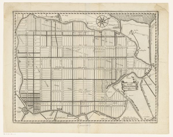
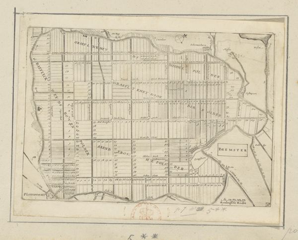
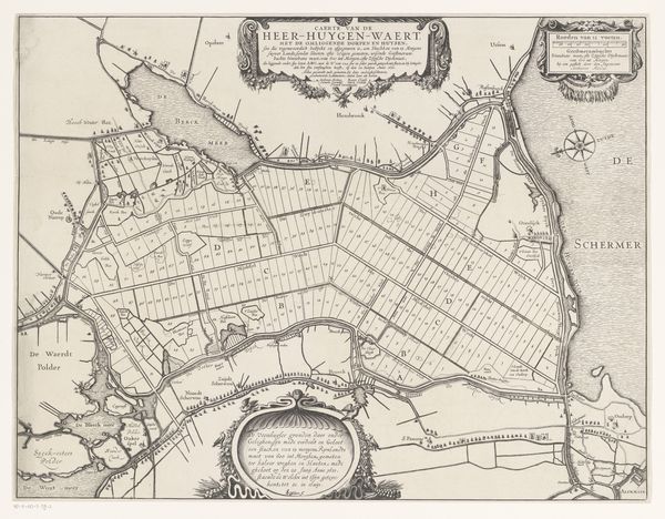
This map presents the Beemster, a polder in the Netherlands, methodically reclaimed from water. The grid-like structure, reminiscent of a Roman centuriation, speaks volumes about man's ambition to impose order upon nature. The Beemster is laid out in an orderly grid, a symbolic assertion of human will over the chaotic forces of nature. The act of draining and dividing land resonates with ancient creation myths where gods separate earth from water, imposing order on the primordial chaos. This motif of imposing order can be seen echoed in the Renaissance architectural drawings that idealize symmetrical cities. Consider, too, the psychological drive behind such endeavors. Is it not a reflection of our own internal struggle to control and compartmentalize our fears, desires, and unconscious impulses? The Beemster, in its stark geometry, becomes a symbol of the collective human effort to control the uncontrollable. This endeavor is a continuous cycle that repeats throughout history.
Comments
No comments
Be the first to comment and join the conversation on the ultimate creative platform.
More like this