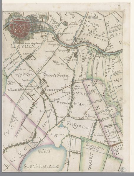
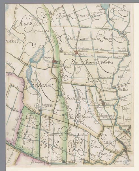
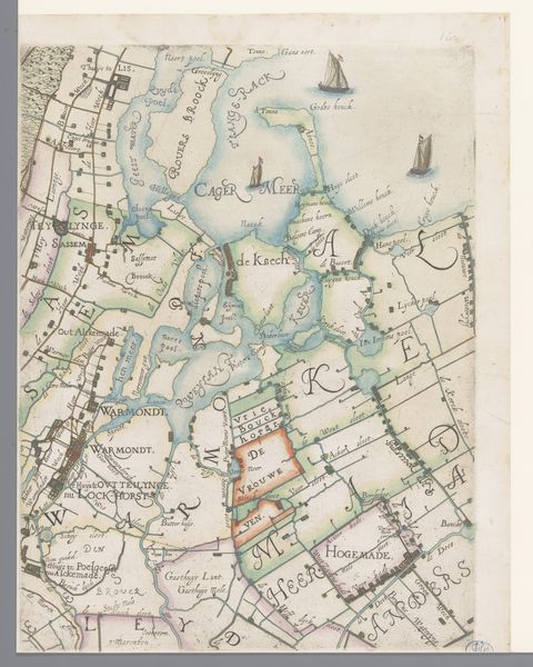
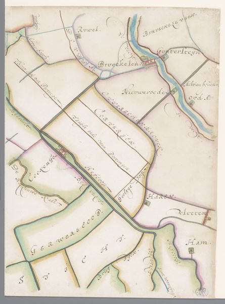
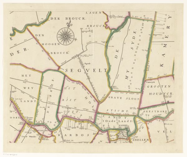
Kaart van het Hoogheemraadschap van Delfland, met Schipluiden en Maasland, deel midden onder 1611 - 1692
0:00
0:00
florisbalthasarszvanberckenrode
Rijksmuseum
drawing, print, paper
#
architectural sketch
#
drawing
#
aged paper
#
dutch-golden-age
# print
#
sketch book
#
landscape
#
paper
#
personal sketchbook
#
bold pencil line
#
sketchwork
#
sketchbook drawing
#
storyboard and sketchbook work
#
sketchbook art
#
botanical art
Dimensions: height 384 mm, width 299 mm
Copyright: Rijks Museum: Open Domain
Curator: Here we have an intriguing map, specifically "Kaart van het Hoogheemraadschap van Delfland, met Schipluiden en Maasland, deel midden onder." Created sometime between 1611 and 1692 by Floris Balthasarsz van Berckenrode, this print and drawing on paper is held at the Rijksmuseum. Editor: My first thought? Whimsy. Look at those elaborate, almost playful calligraphic place names! It feels less like a strict navigational tool and more like…well, a decoration? Or a game board. Curator: The formal elements definitely lean into the decorative. Note the limited color palette, primarily pastel washes defining different land parcels. Consider also how the lines delineate space, almost irrespective of naturalistic accuracy, to highlight the polder system. Editor: It does have a naive charm to it, doesn't it? The little ships bobbing on the "Sant Plats" are especially sweet. You almost forget these waterways were crucial for trade and defense. It's romanticizing the landscape. Curator: Or, perhaps more precisely, it's instrumentalizing it. Remember, this map served a very particular function: documenting and regulating water management in Delfland. The aesthetic choices reinforce the perception of controlled, orderly territory. Observe how "Polder" is proudly appended after each locale! Editor: Right, those little ships... Maybe they aren't so sweet after all, just there to assert control over all that watery space. It’s easy to get lost in the pretty pastels, you’re correct; I should probably avoid getting too distracted. It is gorgeous aged paper, though. Curator: Indeed. We might interpret the aged paper, with its inherent imperfections, as adding a layer of historical authentication and gravitas. Editor: Yes, and what about the negative space and almost complete absence of topographical realism that really draws you in. Makes it a statement more than just a source of fact. Fascinating how a seemingly straightforward document is actually a complex visual argument. Curator: A visual argument predicated on asserting dominion over the land itself. Editor: Right, thanks for helping me chart my course. A fascinating blend of power and aesthetics.
Comments
No comments
Be the first to comment and join the conversation on the ultimate creative platform.
More like this