Deel van een kaart van het Hoogheemraadschap van Rijnland, met Breukelen en omgeving 1615
florisbalthasarszvanberckenrode
Rijksmuseum
drawing, print, etching, watercolor, ink
drawing
dutch-golden-age
etching
landscape
etching
watercolor
ink
architectural drawing
architecture drawing
Dimensions: height 386 mm, width 280 mm
Copyright: Rijks Museum: Open Domain
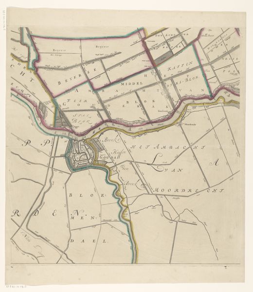
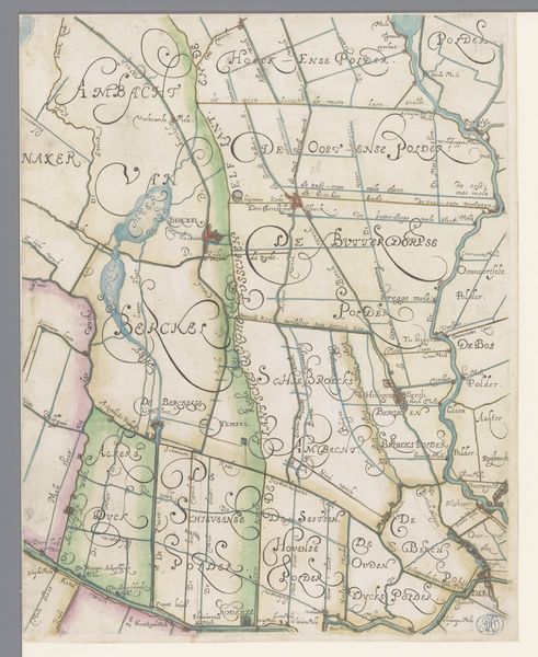
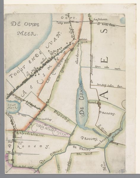
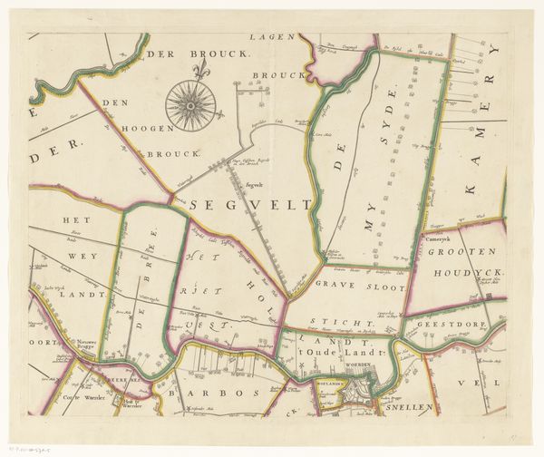
Curator: Here we have "Deel van een kaart van het Hoogheemraadschap van Rijnland, met Breukelen en omgeving," which translates to "Part of a map of the High Authority of Rijnland, with Breukelen and surroundings." It's a 1615 work by Floris Balthasarsz van Berckenrode currently housed at the Rijksmuseum. It employs drawing, etching, ink and watercolor, a combination reflecting its time. Editor: My first thought? It looks remarkably fresh. The pastel washes are almost... calming. It feels like a meditation on land management, somehow. The thin, dark lines carving out shapes within shapes – are those plots of land? Curator: Indeed. This map is more than just aesthetics; it's a document illustrating land division and water management strategies within the Rijnland district. Note the presence of ink and etching alongside watercolor. These denote its printing processes as integral to production of functional art—in other words, these types of maps existed for use as instruments. The deliberate choice of material is integral to accessibility and communication during that period. Editor: Fascinating. And look at the names sprinkled across it: "Breukelen," the original Brooklyn! It feels so intimate, handwritten... each section meticulously bordered and annotated. Almost like looking at someone's garden from above. Curator: Right! Each color designates ownership of water usage rights, plot divisions, infrastructure for processing materials, etc. Watercolor allowed for precision without excessive ink blotting that might obscure land demarcation information etched beforehand on metallic printing plates, an innovation significantly affecting land control that deserves recognition beyond “a pretty garden from above”. Editor: A control schematic then masked as placid watercolors, yes! Looking closer, there's a delightful tension in these pale hues bound by hard lines. There are micro details such as tiny brick house icons in an unassuming palette... So, these colors belie a whole network built and controlled around its waters? Curator: Precisely. We see aesthetic choice informing legibility: A perfect summary encapsulates the power structures interwoven directly into that era. It allows effective access both cartographically (for accurate measuring and reading of key data) and visually as persuasive material that makes property laws much clearer! Editor: It feels oddly poetic now, seeing such labor articulated plainly on what looks at first to be quaint rendering. Looking back over it all makes the history much tangible even so long later, so much conveyed with a gentle wash and an etched line. What starts simple actually ends deep and rich as you understand its place as critical element regulating civil planning and economics alongside its utility aesthetic appeal
Comments
No comments
Be the first to comment and join the conversation on the ultimate creative platform.