About this artwork
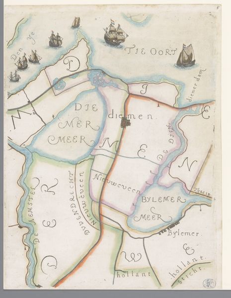
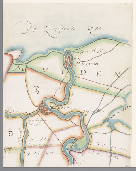
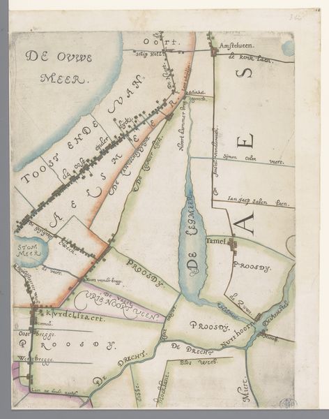
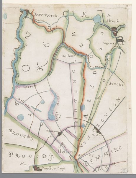
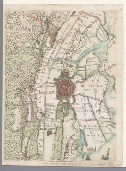
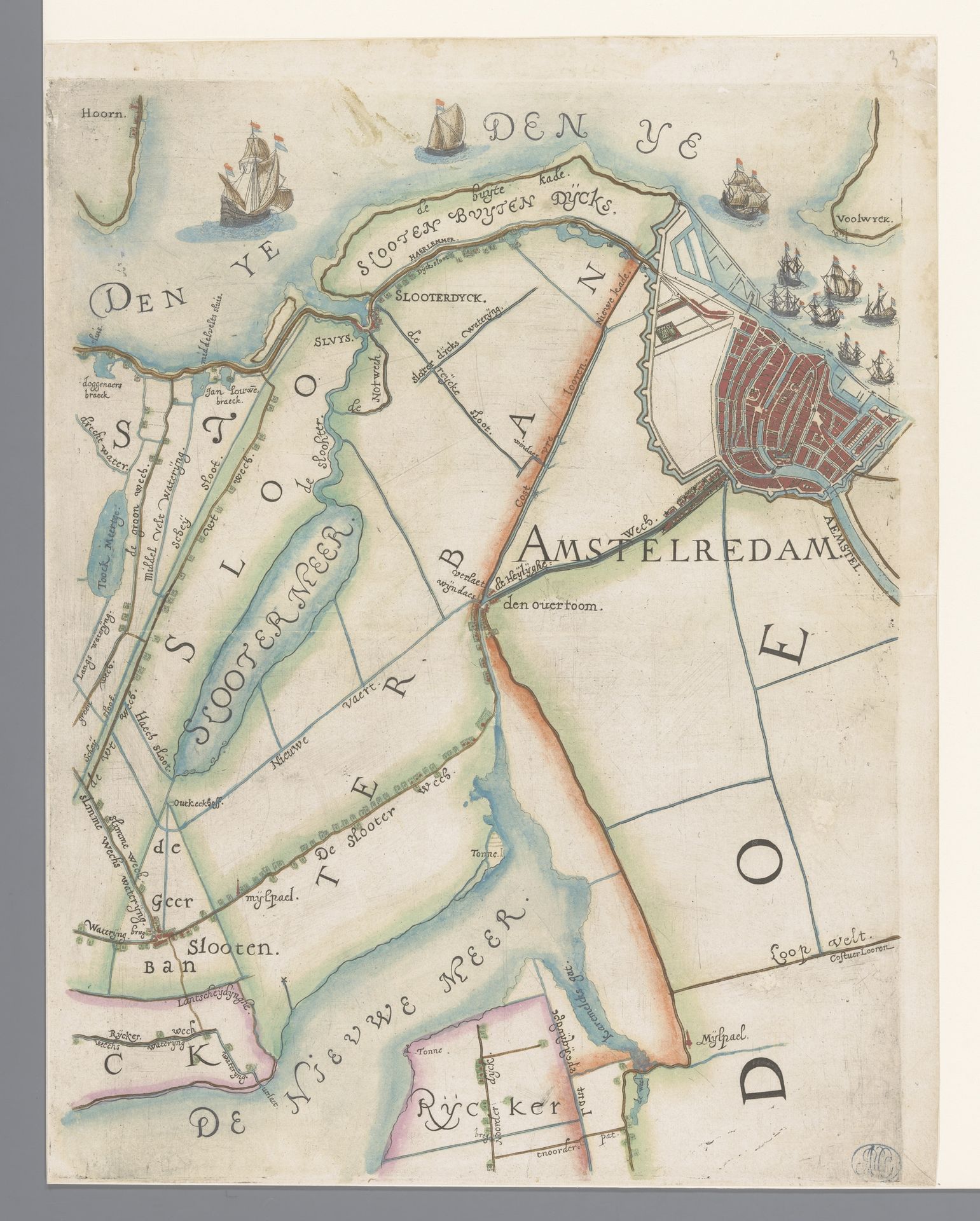
Curator: This map just whispers adventure, doesn’t it? So detailed and whimsical! It is titled "Deel van een kaart van Rijnland, met Amsterdam en omgeving", or "Part of a map of Rhineland, with Amsterdam and surroundings" dating back to 1615. The artist here is Floris Balthasarsz van Berckenrode. It’s ink on paper, residing right here in the Rijksmuseum. What leaps out at you? Editor: Right away, the careful division between the land and the water—it feels like a commentary on spatial power. Each carefully marked plot becomes a statement. Maps weren’t just geographical aids. They were tools of colonialism, ownership, and the consolidation of capital. Curator: Absolutely. Maps are so much more than just representations of places; they're stories in themselves. Look at Amsterdam so vividly colored in! All that red against the beige. Do you think it signifies vitality, the heart of the region? Editor: The red definitely emphasizes Amsterdam's importance. But the rendering also brings forth a critical viewpoint. The control of territory and resources, the marking of boundaries - who benefited from that control, and at whose expense? Think of the people displaced or whose claims were erased in service of "progress". Curator: Yes, there’s the beautiful and the unsettling woven together here. See the ships dotted around, braving the waters? I like how they look so precarious against the immensity of it all. They add a sort of dramatic flair to what might otherwise be a very academic landscape. Editor: Right. It’s a powerful reminder that our present is rooted in complicated pasts, which continue to impact who has access to resources, power, and visibility today. Curator: Indeed. Even through its aesthetic charm, the map prods us. Thank you for your thoughtful insights! Editor: It makes one wonder who these landscapes truly belong to.
Deel van een kaart van Rijnland, met Amsterdam en omgeving 1615
Floris Balthasarsz van Berckenrode
1562 - 1616Location
RijksmuseumArtwork details
- Medium
- drawing, paper, ink
- Dimensions
- height 370 mm, width 287 mm
- Location
- Rijksmuseum
- Copyright
- Rijks Museum: Open Domain
Tags
drawing
dutch-golden-age
landscape
paper
ink
cityscape
Comments
No comments
About this artwork
Curator: This map just whispers adventure, doesn’t it? So detailed and whimsical! It is titled "Deel van een kaart van Rijnland, met Amsterdam en omgeving", or "Part of a map of Rhineland, with Amsterdam and surroundings" dating back to 1615. The artist here is Floris Balthasarsz van Berckenrode. It’s ink on paper, residing right here in the Rijksmuseum. What leaps out at you? Editor: Right away, the careful division between the land and the water—it feels like a commentary on spatial power. Each carefully marked plot becomes a statement. Maps weren’t just geographical aids. They were tools of colonialism, ownership, and the consolidation of capital. Curator: Absolutely. Maps are so much more than just representations of places; they're stories in themselves. Look at Amsterdam so vividly colored in! All that red against the beige. Do you think it signifies vitality, the heart of the region? Editor: The red definitely emphasizes Amsterdam's importance. But the rendering also brings forth a critical viewpoint. The control of territory and resources, the marking of boundaries - who benefited from that control, and at whose expense? Think of the people displaced or whose claims were erased in service of "progress". Curator: Yes, there’s the beautiful and the unsettling woven together here. See the ships dotted around, braving the waters? I like how they look so precarious against the immensity of it all. They add a sort of dramatic flair to what might otherwise be a very academic landscape. Editor: Right. It’s a powerful reminder that our present is rooted in complicated pasts, which continue to impact who has access to resources, power, and visibility today. Curator: Indeed. Even through its aesthetic charm, the map prods us. Thank you for your thoughtful insights! Editor: It makes one wonder who these landscapes truly belong to.
Comments
No comments