About this artwork
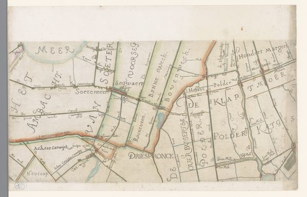
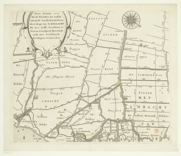
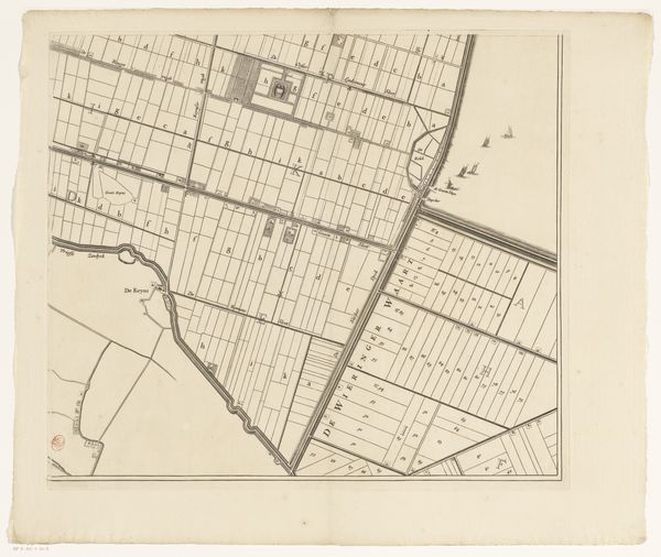
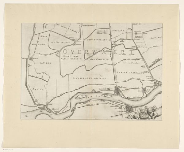
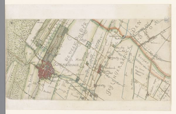
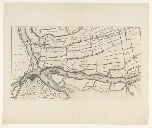
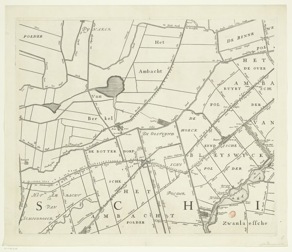
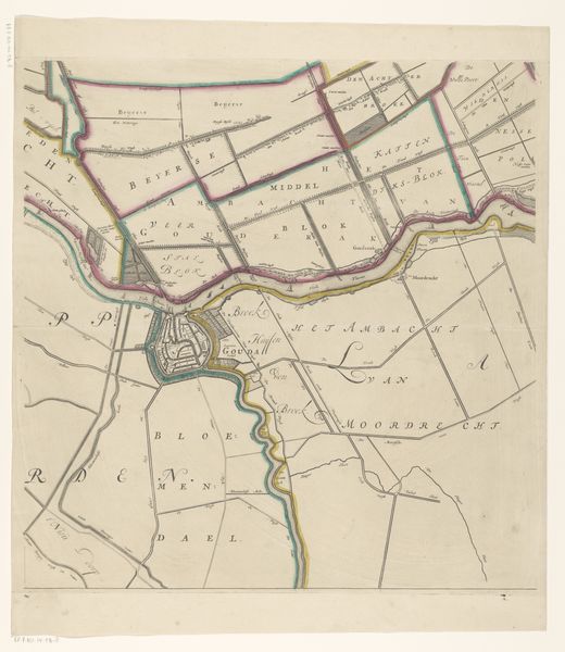
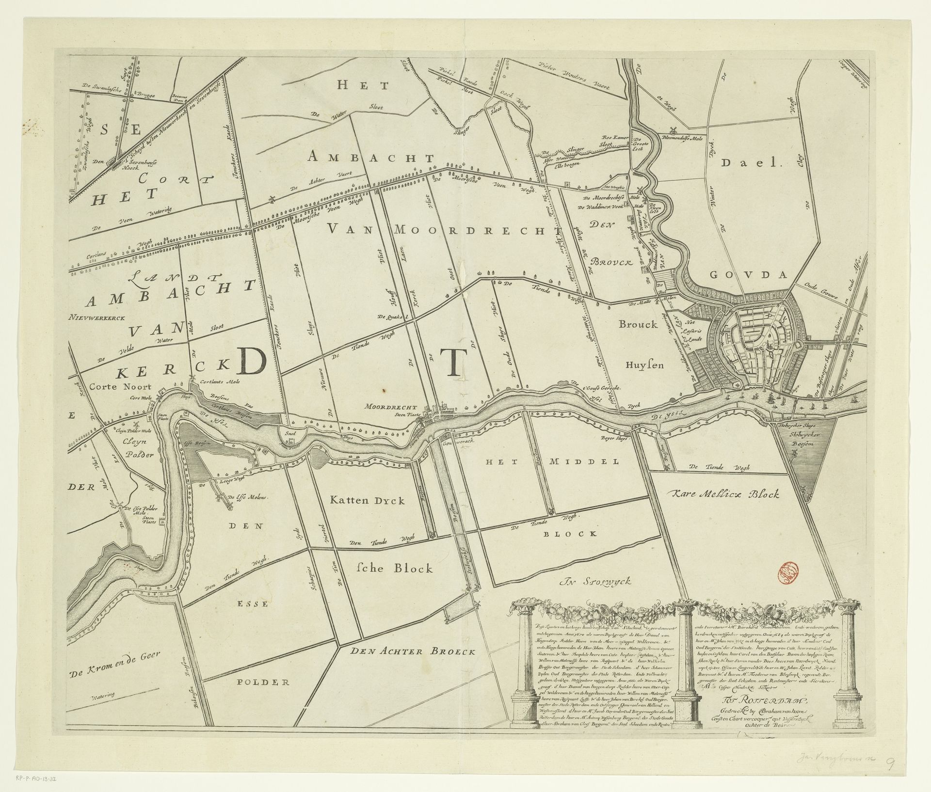
Editor: Here we have “Kaart van het Hoogheemraadschap van Schieland (negende deel)”, made between 1684 and 1718. It's a print, an etching, by Johannes Vinckboons. The precision and detail are impressive, almost technical in a way. What strikes you about this piece? Curator: As a materialist, I see this map not just as a representation of land, but as a testament to human intervention. Look at the lines etched into the plate – the very process speaks volumes about the labour and technical skill involved in controlling and manipulating the landscape. How does the method of production—etching—itself shape our understanding of the territory represented? Editor: That's interesting. I was focused on the aesthetic quality of the lines, but the fact that it’s an etching, a manufactured object, really highlights the human influence, not just the geographical features. Curator: Precisely. And consider the context: The Dutch Golden Age, a period of intense land reclamation and water management. This map isn't just about passively depicting space; it’s actively participating in a social and economic project. How do you think the map's function as a tool of governance influences its design and execution? Editor: So it's both art and... propaganda, in a way? Designed to assert control. It also speaks of consumption. Curator: "Propaganda" might be too strong, but certainly a tool of power. Think about who commissioned it, who used it, and what that tells us about resource distribution and social hierarchy at the time. Editor: Right. It shows me there are many facets of a piece we often overlook. Thanks, I will reconsider "objective" pieces with new eyes from now on. Curator: And I will work to consider beyond a materialist lens from time to time.
Kaart van het Hoogheemraadschap van Schieland (negende deel)
1684 - 1718
Johannes Vinckboons
1617 - 1670Location
RijksmuseumArtwork details
- Medium
- print, etching
- Dimensions
- height 496 mm, width 595 mm
- Location
- Rijksmuseum
- Copyright
- Rijks Museum: Open Domain
Tags
Comments
Share your thoughts
About this artwork
Editor: Here we have “Kaart van het Hoogheemraadschap van Schieland (negende deel)”, made between 1684 and 1718. It's a print, an etching, by Johannes Vinckboons. The precision and detail are impressive, almost technical in a way. What strikes you about this piece? Curator: As a materialist, I see this map not just as a representation of land, but as a testament to human intervention. Look at the lines etched into the plate – the very process speaks volumes about the labour and technical skill involved in controlling and manipulating the landscape. How does the method of production—etching—itself shape our understanding of the territory represented? Editor: That's interesting. I was focused on the aesthetic quality of the lines, but the fact that it’s an etching, a manufactured object, really highlights the human influence, not just the geographical features. Curator: Precisely. And consider the context: The Dutch Golden Age, a period of intense land reclamation and water management. This map isn't just about passively depicting space; it’s actively participating in a social and economic project. How do you think the map's function as a tool of governance influences its design and execution? Editor: So it's both art and... propaganda, in a way? Designed to assert control. It also speaks of consumption. Curator: "Propaganda" might be too strong, but certainly a tool of power. Think about who commissioned it, who used it, and what that tells us about resource distribution and social hierarchy at the time. Editor: Right. It shows me there are many facets of a piece we often overlook. Thanks, I will reconsider "objective" pieces with new eyes from now on. Curator: And I will work to consider beyond a materialist lens from time to time.
Comments
Share your thoughts