About this artwork
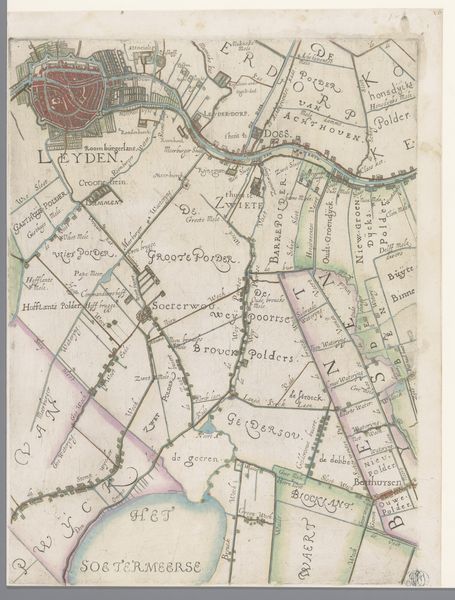
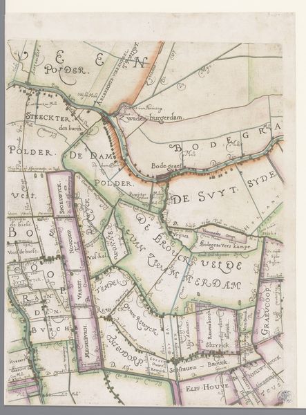
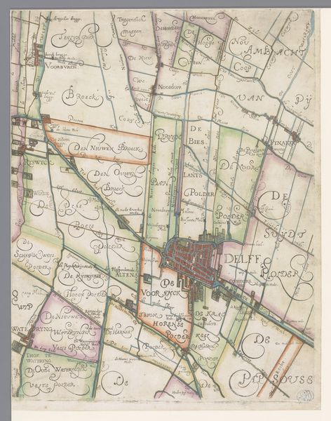
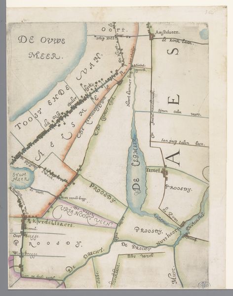
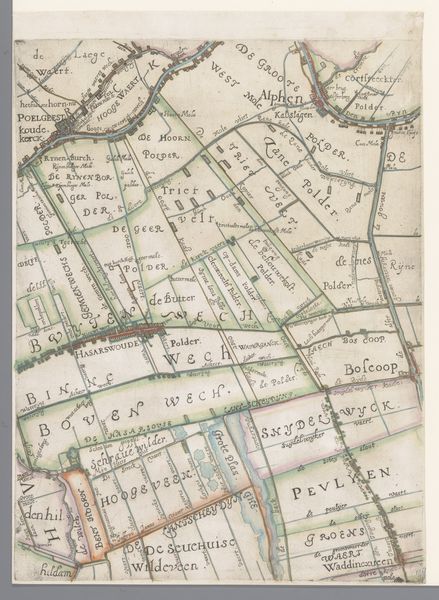
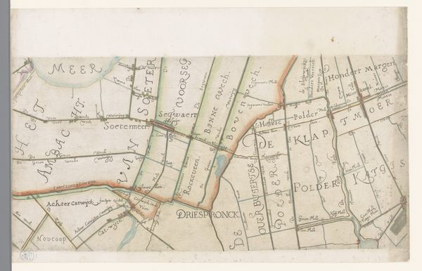
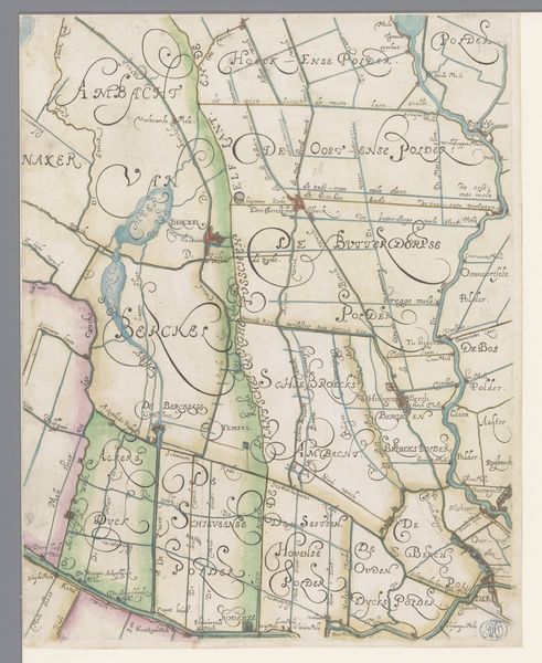
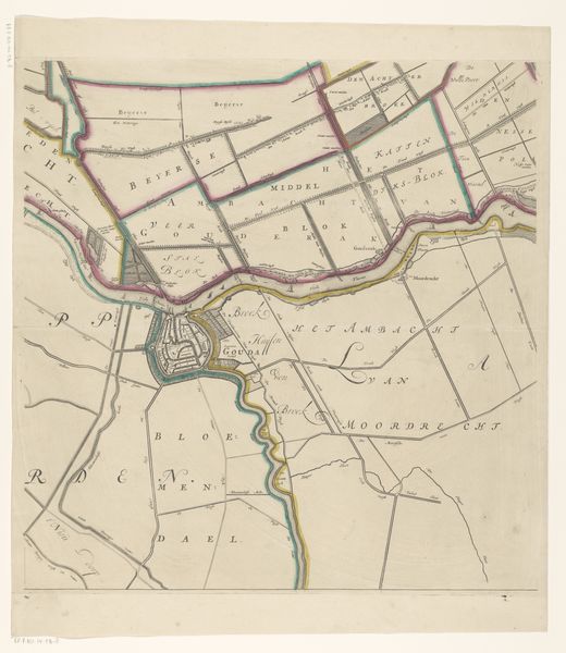
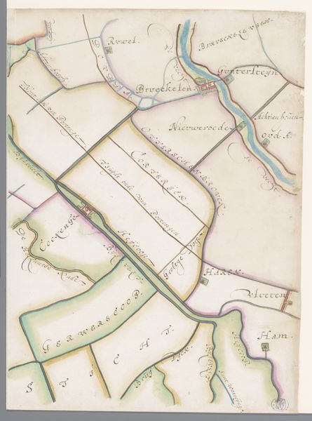
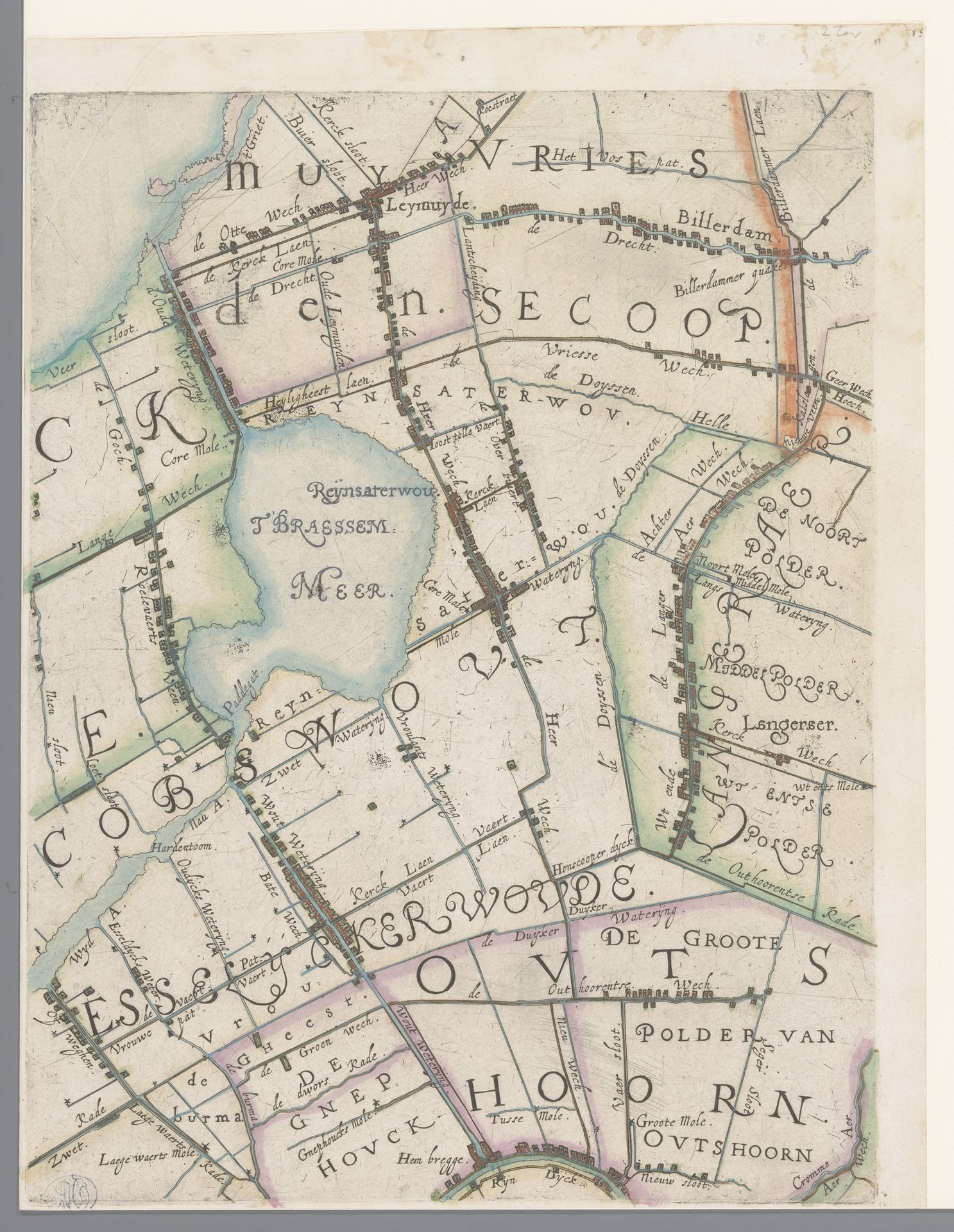
Curator: Here we have “Part of a Map of the Rijnland Water Board, with Leimuiden and the Braassemermeer,” dating back to 1615, crafted by Floris Balthasarsz van Berckenrode. It's a drawing in ink on paper. You know, peering into these old maps is like stumbling upon a half-forgotten dream, don’t you think? It seems to promise journeys both real and imagined. Editor: Absolutely, that description hits the mark. The detail is fascinating, especially given the age. It’s much more than just lines on paper; it feels like peering into the 17th century. What can you tell us about what Berckenrode wanted to capture here, beyond the geographical accuracy? Curator: Oh, more than geographical accuracy, certainly! Imagine him, hunched over his drawing table, painstakingly rendering the Rijnland region. This wasn’t merely about charting land, it was about power, control, and understanding the landscape's influence. I think it mirrors their perception of life itself – ordered, structured, but always at the mercy of the waters. Do you feel a sense of both order and potential chaos in it, perhaps? Editor: I do now that you point it out! It makes me think about how the Dutch were literally creating their own land at this time, battling the sea. So the map is a testament to that struggle and ambition? Curator: Precisely. It speaks volumes about the Dutch Golden Age's spirit. And what a fascinating insight from you! These lines aren't just borders; they're declarations of intent. Editor: It’s amazing how a seemingly straightforward map can reveal such layers of history and meaning. I never considered maps as being so… expressive. Curator: Exactly! They're narratives in disguise. Keeps you on your toes, doesn't it? Always question what you see... especially in art!
Deel van een kaart van het Hoogheemraadschap van Rijnland, met Leimuiden en het Braassemermeer 1615
Floris Balthasarsz van Berckenrode
1562 - 1616Location
RijksmuseumArtwork details
- Medium
- drawing, paper, ink
- Dimensions
- height 355 mm, width 271 mm
- Location
- Rijksmuseum
- Copyright
- Rijks Museum: Open Domain
Tags
drawing
map drawing
dutch-golden-age
landscape
paper
ink
geometric
Comments
No comments
About this artwork
Curator: Here we have “Part of a Map of the Rijnland Water Board, with Leimuiden and the Braassemermeer,” dating back to 1615, crafted by Floris Balthasarsz van Berckenrode. It's a drawing in ink on paper. You know, peering into these old maps is like stumbling upon a half-forgotten dream, don’t you think? It seems to promise journeys both real and imagined. Editor: Absolutely, that description hits the mark. The detail is fascinating, especially given the age. It’s much more than just lines on paper; it feels like peering into the 17th century. What can you tell us about what Berckenrode wanted to capture here, beyond the geographical accuracy? Curator: Oh, more than geographical accuracy, certainly! Imagine him, hunched over his drawing table, painstakingly rendering the Rijnland region. This wasn’t merely about charting land, it was about power, control, and understanding the landscape's influence. I think it mirrors their perception of life itself – ordered, structured, but always at the mercy of the waters. Do you feel a sense of both order and potential chaos in it, perhaps? Editor: I do now that you point it out! It makes me think about how the Dutch were literally creating their own land at this time, battling the sea. So the map is a testament to that struggle and ambition? Curator: Precisely. It speaks volumes about the Dutch Golden Age's spirit. And what a fascinating insight from you! These lines aren't just borders; they're declarations of intent. Editor: It’s amazing how a seemingly straightforward map can reveal such layers of history and meaning. I never considered maps as being so… expressive. Curator: Exactly! They're narratives in disguise. Keeps you on your toes, doesn't it? Always question what you see... especially in art!
Comments
No comments