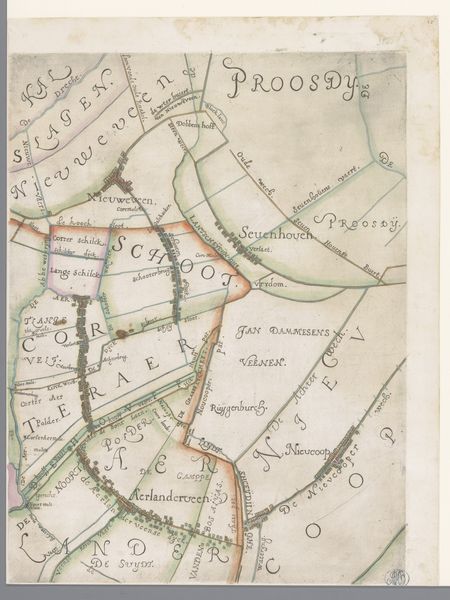
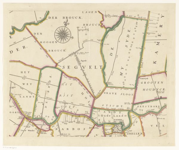
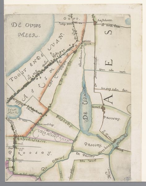
Deel van een kaart van het Hoogheemraadschap van Rijnland, met Leiden en omgeving 1615
florisbalthasarszvanberckenrode
Rijksmuseum
drawing, ink
drawing
map drawing
dutch-golden-age
landscape
ink
Dimensions: height 365 mm, width 273 mm
Copyright: Rijks Museum: Open Domain
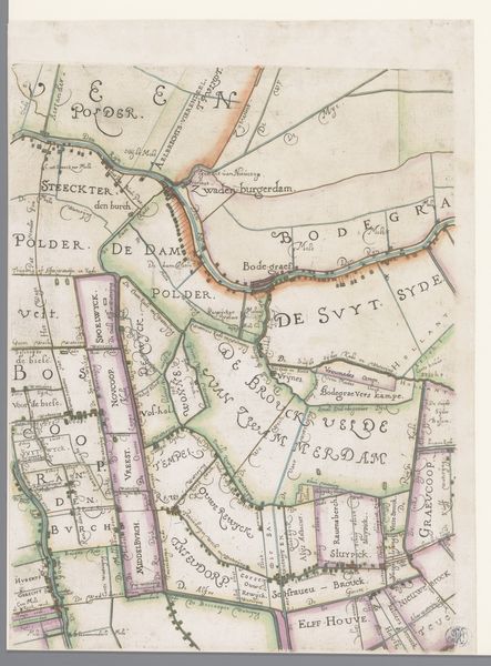
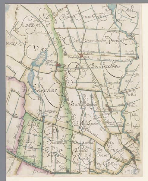
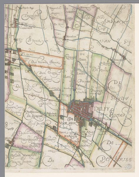
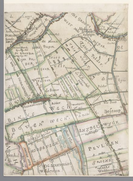
This section of a map, depicting Leiden and its surroundings, was created around the turn of the 17th century by Floris Balthasarsz van Berckenrode. It is made using ink on paper, with watercolor washes to differentiate the landscape. While maps are often thought of as purely informational, this one is a beautiful example of craft. The topographical details are meticulously rendered, with a remarkable level of detail. The use of color adds depth and visual interest, transforming a utilitarian document into a work of art. This map also speaks to the intense human effort required to create the Dutch landscape we know today. The region was fundamentally shaped by land reclamation projects, reflected in the many “polders” labeled here. These reclaimed lands were not simply a feat of engineering. They were also an assertion of human will, a testament to the power of collective labor to reshape the natural world.
Comments
No comments
Be the first to comment and join the conversation on the ultimate creative platform.