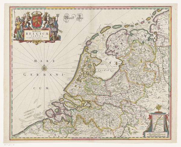
Kaart van de Republiek der Zeven Verenigde Nederlanden en een deel van het Heilige Roomse Rijk after 1696
0:00
0:00
print, engraving
#
dutch-golden-age
# print
#
landscape
#
cityscape
#
engraving
Dimensions: height 450 mm, width 537 mm
Copyright: Rijks Museum: Open Domain
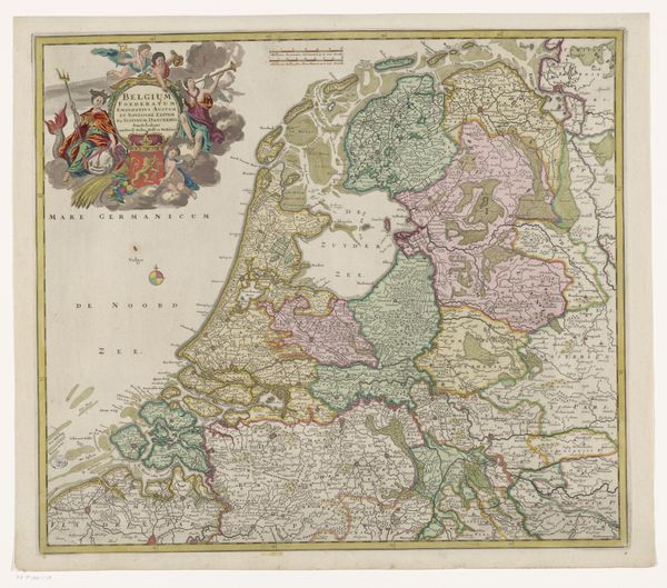
This anonymous map depicts the Republic of the Seven United Netherlands and part of the Holy Roman Empire. Cartography was transformed in the 17th Century by the Dutch, whose maps combined artistry with scientific accuracy. Looking closer, notice the elaborate embellishments like the cherubic figures, the heraldic crest, and the ships at sea. These were visual codes designed to glorify the Republic, which was then a major economic and naval power. The map served not only as a practical navigational tool but also as a political statement, asserting Dutch dominance in trade and maritime affairs. It's no accident that the map includes a portion of the Holy Roman Empire, reminding viewers of the Republic’s territorial ambitions and its relationship with its neighbors. Historians of cartography use many tools to uncover the social meanings embedded in maps like these. By consulting period documents, we can better understand the intersection of art, power, and commerce in the Dutch Golden Age.
Comments
No comments
Be the first to comment and join the conversation on the ultimate creative platform.
More like this