drawing, print, paper, ink, engraving
#
drawing
#
medieval
#
pen drawing
#
dutch-golden-age
# print
#
landscape
#
paper
#
ink line art
#
ink
#
geometric
#
pen-ink sketch
#
line
#
cityscape
#
engraving
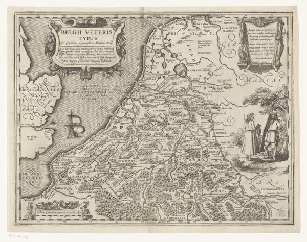
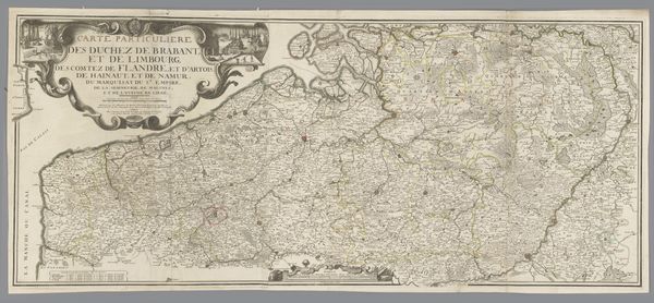
Dimensions: height 417 mm, width 540 mm
Copyright: Rijks Museum: Open Domain
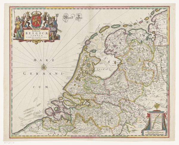
Curator: What a find! We’re looking at a fascinating map— “Kaart van Friesland”—thought to have been made sometime between 1618 and 1665 by an anonymous artist. It's currently housed in the Rijksmuseum. Editor: Immediately, I’m struck by the sheer density of information packed into this print. It feels like an attempt to capture a world, or at least a province, in its entirety. So much detail, it's a marvel someone managed to capture all of that by hand with ink. Curator: It’s a masterful engraving, that’s for sure! You see the fine linework giving shape to the Frisian landscape. And if you look along the borders of the piece you will find charming cityscapes framing the central map of the province, little windows into life at that time, almost like annotations. Editor: And note the strategic positioning of maritime activities—sailing ships traversing waterways! What can they be importing or exporting? It paints a vivid picture, though perhaps sanitized. It is really telling of the prominence that sea travel played in the time the artwork was made and its perceived social importance, as such prominence may distract from some important points such as the land-locked activities, perhaps? Curator: Absolutely! And, in the four corners of the piece are these beautifully rendered figures, almost archetypal representations of local people, dressed in what I imagine are their traditional garments. Each tiny rendering seems to speak to local customs and trade. I feel it invites reflection on Friesland and its population at the time. I just want to invent stories for each of them... Editor: These are such compelling considerations to have. Looking at the clothing and landscape features might help one see Friesland at a point of self-discovery. But perhaps in the selection, as it depicts clear scenes of Dutch life, it promotes Dutch colonial ideas on other territories too? Curator: Yes, definitely food for thought as you contemplate it, and as the Dutch saying goes "it tickles your fantasy"! Editor: What a fascinating look into how history and artistic expression intersect, it makes me ponder the nature of identity itself.
Comments
No comments
Be the first to comment and join the conversation on the ultimate creative platform.
More like this