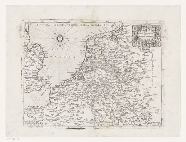
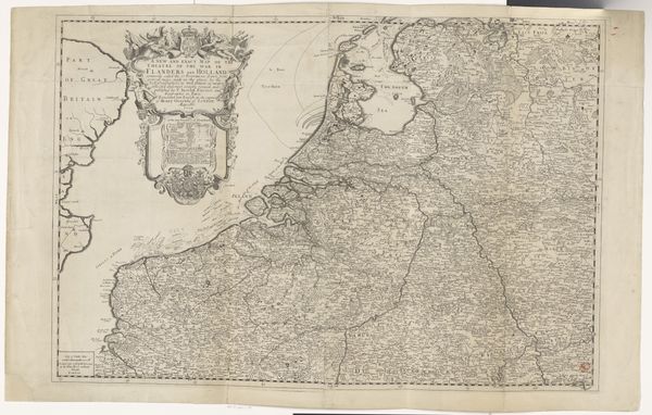
Historische kaart van Nederland in de tweede helft van de zestiende eeuw 1752
0:00
0:00
anonymous
Rijksmuseum
graphic-art, print, etching, paper
#
graphic-art
#
medieval
# print
#
etching
#
landscape
#
etching
#
paper
#
geometric
#
history-painting
#
decorative-art
Dimensions: height 326 mm, width 372 mm
Copyright: Rijks Museum: Open Domain
This is an anonymous map of the Netherlands in the second half of the sixteenth century. Produced during a transformative period, it reflects a time of political upheaval and cultural reformation in the region. As we look at this map, we must think about how representations of land are always intertwined with power. Consider, for instance, that the sixteenth century was marked by the Dutch Revolt against Spanish rule; maps like these were not just geographical tools, but statements of identity and territorial claims. This map emphasizes the region's complex waterways and provincial boundaries, visualizing a society in flux. Think about who might have used this map – merchants, military leaders, or perhaps political figures? Their perspectives and interests would undoubtedly shape how they interpreted it. What does it mean to lay claim to land? To draw it out, name its parts, and define its borders? Maps are rarely neutral; they embody the aspirations and anxieties of those who create and use them. Consider the map as a cultural artifact that captures a specific moment.
Comments
No comments
Be the first to comment and join the conversation on the ultimate creative platform.
More like this