print, engraving
aged paper
baroque
pen sketch
old engraving style
sketch book
personal sketchbook
pen-ink sketch
pen work
sketchbook drawing
storyboard and sketchbook work
sketchbook art
engraving
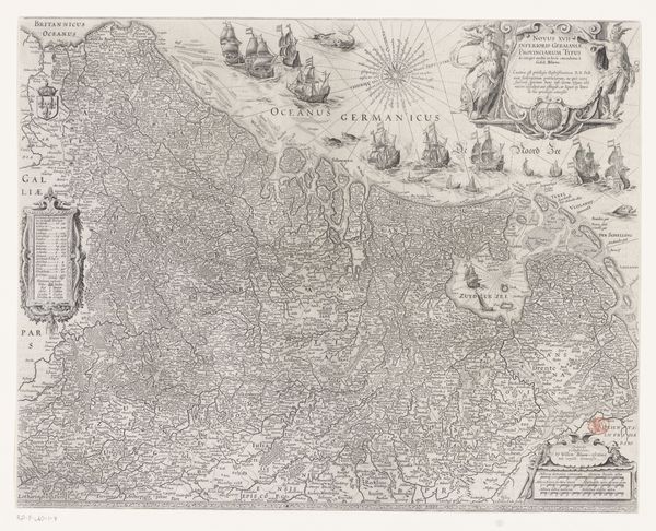
Dimensions: height 501 mm, width 590 mm
Copyright: Rijks Museum: Open Domain
Curator: The work before us, titled "Kaart van de Zeventien Provinciën," which translates to "Map of the Seventeen Provinces," was created sometime between 1720 and 1730 by Matthaeus Seutter III. It’s an engraving, a print, meticulously crafted. Editor: It feels strangely…authoritative and playful at the same time? It's like a bureaucrat moonlighting as a cherubic cake decorator, you know? So many fine lines and these baroque flourishes give it almost a celebratory air. Curator: The map itself charts what was then known as the Seventeen Provinces, a region encompassing much of the Low Countries: parts of modern-day Netherlands, Belgium, and bits of northern France. These maps played a critical role in defining and solidifying territorial claims. Seutter was based in Augsburg, and it’s a reprint. The interesting question is to whose version it is adapted? Editor: So it was a way of saying, "This is ours"? That is fascinating considering this old world political framing and new globalized thinking... Do you think there is tension between the ornamental stuff on the periphery and the, you know, actual borders in the map's meat of the matter? I keep wondering why it isn't printed larger... Curator: Maps always have their political messages encoded into them and this map’s ornate border, overflowing with figures and symbols, would have resonated with an 18th-century audience. Editor: This really is a great example of how information can be not only political but beautiful and kind of surreal. I want this hanging over my kitchen stove so I can fantasize that Brussels sprouts are cities. Curator: Indeed. These kinds of prints played a part in both science and the making of cultural objects during the enlightenment era. Editor: Well, now I’ll definitely look at maps differently... I may even buy a compass.
Comments
No comments
Be the first to comment and join the conversation on the ultimate creative platform.