graphic-art, print, engraving
#
graphic-art
#
dutch-golden-age
# print
#
old engraving style
#
geometric
#
decorative-art
#
engraving
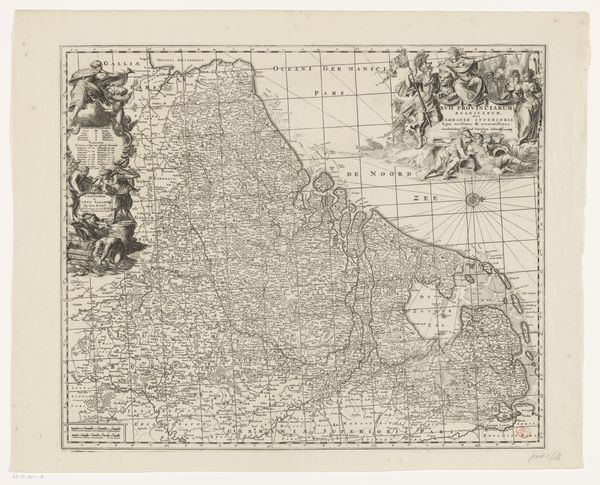
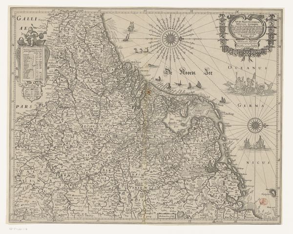
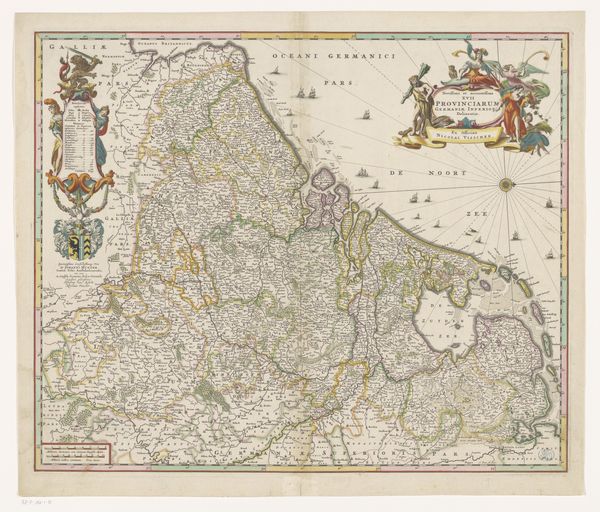
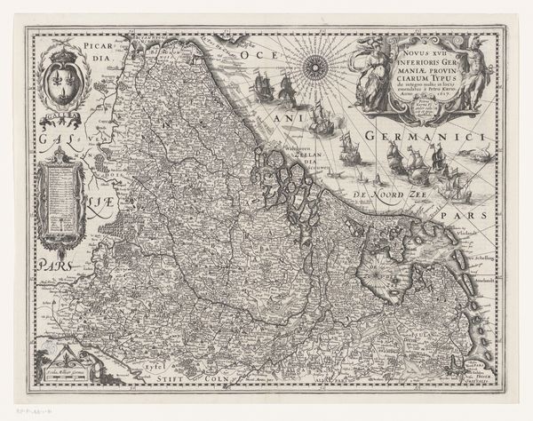
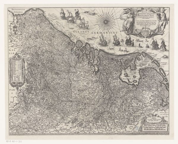
Dimensions: height 475 mm, width 550 mm
Copyright: Rijks Museum: Open Domain
Editor: Here we have "Kaart van de Zeventien Provinciën," a map of the Seventeen Provinces, created sometime between 1666 and 1710 by Abraham Jansz. Deur. It's an engraving, intricate and detailed, like peering into a distant, ordered world. What catches your eye? Curator: The ornamental cartouches framing the title are quite evocative. These allegorical figures—wisdom, strength, abundance perhaps—were not merely decorative. They visually anchor the idea of the provinces as a cohesive, prosperous entity. Note the heraldic symbols too. They signal a cultural memory, an aspirational vision of unity amid political fragmentation. Editor: Fragmentation? So, the map isn't just about geography? Curator: Precisely. The very act of depicting these provinces together suggests a longing for a unified identity, a shared cultural space that transcends political realities of the time. Do you see how the compass rose becomes a central, almost symbolic feature? Editor: Yes, it's like the provinces are all oriented toward the same future or ideal. Curator: Consider the symbolic weight of cartography itself. Mapping isn't just a science; it's an act of claiming, defining, and therefore possessing territory – both physically and conceptually. It's a powerful statement of identity. How does it affect you emotionally? Editor: It makes me wonder what these symbols meant to the people living then. Almost like visual propaganda, trying to build a national identity through art. Curator: Indeed! A complex interplay of art, politics, and cultural aspiration. Recognizing the visual grammar reveals volumes. Editor: I never thought I could read a map this way, understanding how it shows an emotional world. Thank you for the insight. Curator: My pleasure. These maps provide lasting perspectives through intricate engravings.
Comments
No comments
Be the first to comment and join the conversation on the ultimate creative platform.
More like this