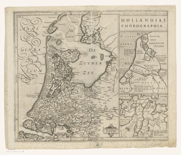
print, engraving
# print
#
landscape
#
geometric
#
line
#
history-painting
#
engraving
Dimensions: height 498 mm, width 592 mm
Copyright: Rijks Museum: Open Domain
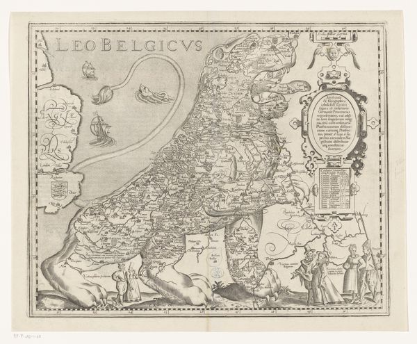
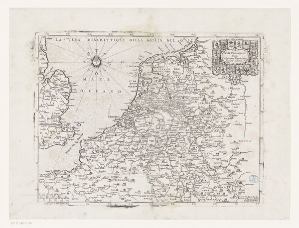
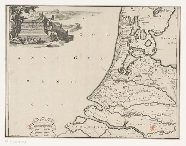
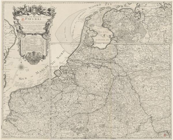
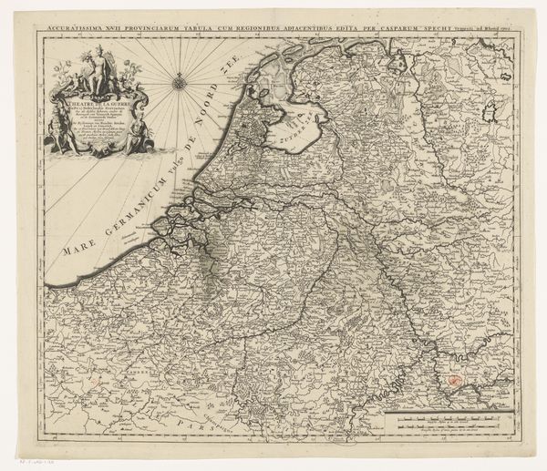
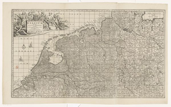
Curator: Here we have an early 18th-century engraving currently held at the Rijksmuseum. It’s titled "Kaart van de Zeventien Provinciën," or Map of the Seventeen Provinces. Editor: My first impression is of incredible detail and precision. It's fascinating how so much information is conveyed through delicate lines. The overall effect, though, feels rather austere, doesn't it? Almost… cold? Curator: Maps from this period certainly prioritize accuracy, often serving very specific political or military ends. This map represents the Seventeen Provinces of the Netherlands before 1711. It would have been a potent symbol of geopolitical organization and power at the time. Editor: Right. So, looking at it through the lens of power structures, I can’t help but notice who is missing. Where are the ordinary people, the laborers, the marginalized voices whose lives were intimately tied to this landscape? Their absence is telling. Curator: Absolutely. Consider how the decorative cartouches aren’t mere embellishments. They portray allegorical figures and heraldic symbols. They project an image of prosperity, governance, and control, specifically shaped by and for a ruling class. Editor: Exactly! And look at how that idealized representation glosses over the social inequalities and conflicts present in those territories at that point in time. It raises questions about who produced this map, for whom, and to what end. What narratives were intentionally amplified or suppressed? Curator: Such maps acted as instruments in shaping collective identity, bolstering the power of the governing elite while simultaneously controlling geographical understanding. They visually established the territory as a single political body. Editor: Today, examining the map critically encourages us to confront the legacy of colonialism and imperialism that maps both supported and reproduced. Its visual language created a particular reality that served distinct purposes. Curator: Ultimately, a piece like this offers an opportunity to unpack the complicated and layered relationship between cartography, governance, and representation. Editor: For me, it also underscores the ongoing need to amplify marginalized voices and resist simplistic, celebratory historical narratives.
Comments
No comments
Be the first to comment and join the conversation on the ultimate creative platform.
More like this