print, etching, engraving
#
comic strip sketch
#
aged paper
# print
#
etching
#
old engraving style
#
landscape
#
personal sketchbook
#
ink drawing experimentation
#
geometric
#
pen-ink sketch
#
pen work
#
sketchbook drawing
#
cityscape
#
storyboard and sketchbook work
#
sketchbook art
#
engraving
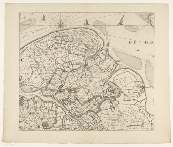
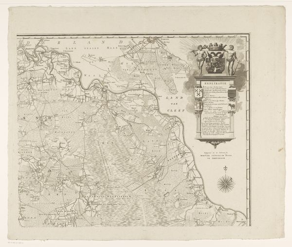
Dimensions: height 214 mm, width 217 mm
Copyright: Rijks Museum: Open Domain
This anonymous map of Breda and its surroundings presents a microcosm of human existence, captured in ink. The compass rose, prominently placed, isn't merely a navigational tool; it’s an ancient symbol of orientation, echoing back to the medieval mappa mundi where Jerusalem sat at the center. The careful charting of villages and waterways is reminiscent of the human desire to impose order on the chaos of the world. Just as ancient cartographers filled uncharted territories with mythical creatures, we project our own fears and fantasies onto the unknown. The very act of mapping—of reducing a sprawling landscape to a bounded circle—reveals our yearning for control and understanding. It's a recurring motif, this impulse to capture and contain, seen in everything from Renaissance cityscapes to modern satellite images. The map invites us to consider how we define our place in the world and how we navigate the labyrinth of our collective memory. The emotional weight of this map lies in its silent witness to countless journeys, battles, and everyday lives, a reminder of the cyclical nature of history and the echoes of the past that resonate in the present.
Comments
No comments
Be the first to comment and join the conversation on the ultimate creative platform.
More like this