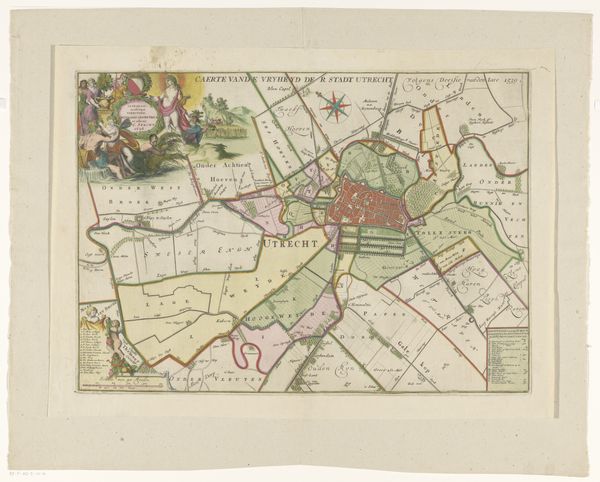
graphic-art, print, engraving
graphic-art
dutch-golden-age
old engraving style
pen-ink sketch
line
pen work
cityscape
engraving
Dimensions: height 380 mm, width 530 mm
Copyright: Rijks Museum: Open Domain
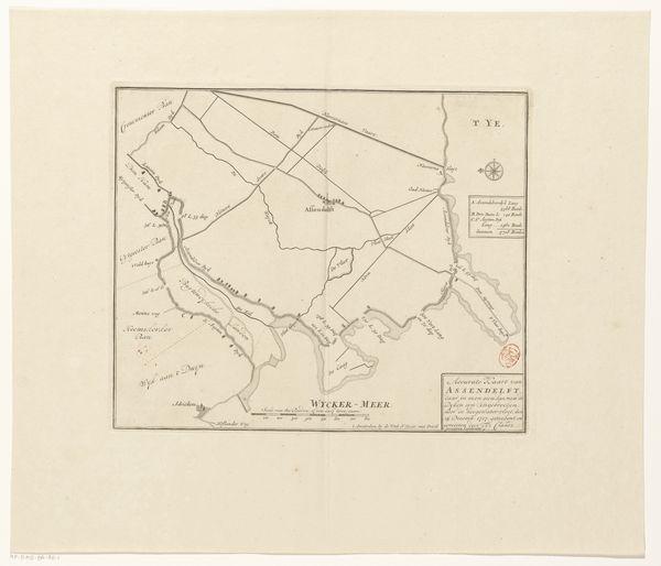
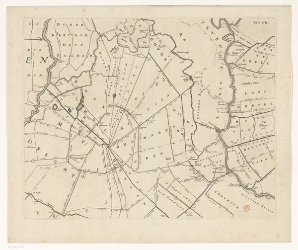
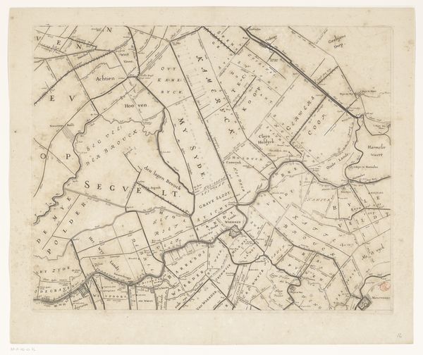
Curator: Here we have a fascinating print titled "Kaart van de stadsvrijheid Utrecht," or "Map of the Freedoms of the City of Utrecht," dating back to 1696. It is currently held in the collection of the Rijksmuseum. Editor: My first impression is how incredibly detailed it is, especially considering the era. The pen work really stands out; it must have required a great deal of skill and patience. And I must admit it’s quite…orderly. Curator: Indeed. As an engraving, likely produced through a combination of etching and engraving, it reflects a particular mode of visualizing power and social organization during the Dutch Golden Age. Note the heraldic imagery and figures framing the cartouche. It speaks volumes about Utrecht's self-image. Editor: I'm curious about the labor involved. How many artisans would have worked on a print like this? We have to imagine the specific craft skills honed and also the social organisation of these processes of reproduction. The ink, paper, even the press used... these materials shape how the final image could be spread. Curator: That's an excellent point. The act of producing and distributing such maps helped solidify Utrecht’s identity, both for its citizens and those outside its borders. The precision wasn't just aesthetic; it served a real purpose in asserting control and defining space. Consider the use of line: does it invoke borders, divisions, security? Editor: Exactly. Plus, it projects an image of control that wasn’t always necessarily true on the ground. How did this specific aesthetic become so pervasive? The very lines create visual barriers. Also notice that most of the symbolic or narrative components, the allegorical scenes and details are kept at the frame; they are ornamental elements. It all seems deliberately planned. Curator: You raise a good point regarding the relationship between the representation and reality. Perhaps its meticulous details offer not just a portrait of Utrecht as it was, but also Utrecht as its leaders wished it to be perceived. A kind of idealized and very ordered existence projected onto the landscape. Editor: And to see it, centuries later, in this particular gallery...it’s a physical document, a surviving material witness of that intention. It reminds us of the power embedded in making and distributing these kinds of images. It leaves me thinking about our contemporary cartography, our satellite imagery, how similar or dissimilar is it in relation to these kinds of aims? Curator: For me, looking at the cartouches framing the map I cannot avoid to feel that beyond their apparent ceremonial purposes, their mere presence is an intentional invitation to question ourselves about the real significance of maps. Editor: I agree; let’s keep mapping those intentions.
Comments
No comments
Be the first to comment and join the conversation on the ultimate creative platform.