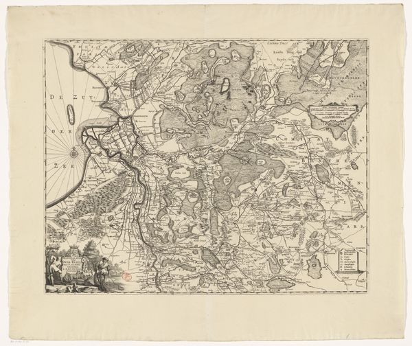
print, engraving
#
neoclacissism
# print
#
history-painting
#
engraving
#
realism
Dimensions: height 552 mm, width 639 mm
Copyright: Rijks Museum: Open Domain
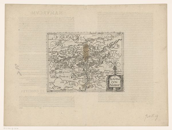
Curator: Ah, yes. Here we have Cornelis van Baarsel’s “Kaart van Brabant (deel rechtsboven),” dating from somewhere between 1794 and 1797. It is an engraving, meticulously rendered. Editor: Immediately striking! A sort of delicate, yet assertive mapping. The detail work and subtle tonal variations in this print really command attention. Curator: Indeed. Baarsel’s technique elevates it beyond a mere geographical record. The very precise lines and shading build up an interesting tension and capture an area of Brabant at a specific historical moment. The symbolic elements on the top-right demand attention; what do you read in these formal choices? Editor: I find it compelling. See how the Neoclassical detail, with its putti flanking the coat of arms, contrasts with the rather pragmatic map. It suggests a fascinating dialogue between ambition and the real-world conditions represented. I suspect these symbolic elements were attempts by political powers to embed notions of legitimacy onto the land itself. Curator: Certainly. Consider that prints like these often served a political function, mapping both territory and power structures. Realism meets propaganda. Furthermore, what is it about engraving, as a medium, that made it a favored option for circulating ideologies or disseminating geographical information to a wider audience at this period? Editor: Excellent point. The mechanical reproduction inherent in engraving made such images accessible. This offered both efficiency and a sense of authority. So it isn't just about disseminating but standardizing perspectives on these territories during an era rife with national and political change. The relatively smooth realism, which feels “neutral” at first, then starts revealing power relations upon closer reading. Curator: I am fully aligned with you! The surface claims objectivity through realistic rendering, but is constantly being undermined when observed at a cultural or political perspective. What a demonstration of intrinsic power. Editor: Precisely! Reflecting upon my initial response, the artwork invites us to examine critically the role such images played in shaping historical understanding and power dynamics during a tempestuous era. Curator: It has truly offered a deep exploration into the dynamic tension between the intrinsic features of print and the wider political context which shaped and has continued to reverberate over the work for over 200 years. Thank you!
Comments
No comments
Be the first to comment and join the conversation on the ultimate creative platform.
More like this