drawing, print, ink, pen, engraving
drawing
pen drawing
ink
pen
engraving
Dimensions: height 553 mm, width 637 mm
Copyright: Rijks Museum: Open Domain
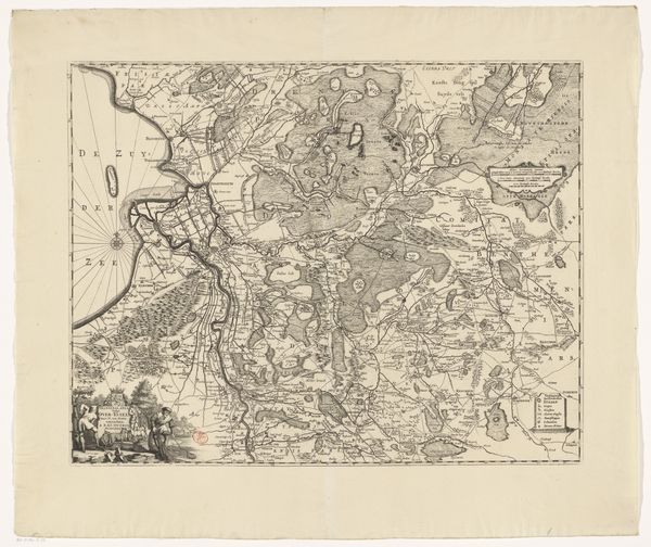
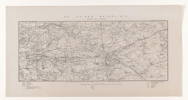
Curator: Today, we’re looking at "Kaart van Brabant (deel linksboven)," a map of Brabant from around 1794-1797, crafted by Cornelis van Baarsel. The work combines drawing, pen, ink, print, and engraving techniques. Editor: My first impression? It feels less like a document and more like a strangely beautiful abstract drawing. So many rivers snaking around, you almost lose sight of it being a map. Curator: Precisely. The work's power lies in the tension between the scientific and the aesthetic. Look at the incredibly precise linework defining the waterways and the deliberate placement of toponyms. It adheres to cartographic principles but possesses artistic flair. Editor: And that faded ink tone, almost sepia, gives it a nostalgic air. It hints at untold stories embedded in this land. It makes you think about the history etched into the landscape. It is an incredible amount of detail, however—you can imagine him sitting and charting, it gives the drawing so much personality. Curator: Indeed. And notice how van Baarsel renders the built environment, the architectural forms represented through tiny precise strokes. It offers clues to the societal structures and economic activities within this region during that era. Editor: Yes, it all is quite organized, as if nature itself adheres to geometry and planned. The human impact, though diminutive at this scale, reveals ambition. Do you wonder if someone was watching what they were working on? Curator: I agree with that. It is hard to pinpoint the cultural context around cartography, it offers glimpses into geographical understanding as well as political intentions. But also an attempt to create something lasting that can stand the test of time, Editor: Ultimately, "Kaart van Brabant" transcends its utilitarian purpose and stands as an object of art. Van Baarsel managed to make geography lyrical. Curator: A synthesis of scientific observation and artistic execution—van Baarsel demonstrates how objectivity and subjectivity can co-exist and enhance one another, broadening its utility, meaning, and reach.
Comments
No comments
Be the first to comment and join the conversation on the ultimate creative platform.