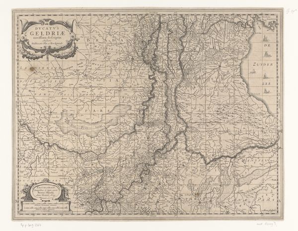
Kaart van een deel van het verloop van de Rijn, de Waal en de Maas 1629 - 1649
anonymous
Rijksmuseum
print, etching, engraving
pen and ink
rippled sketch texture
pen drawing
dutch-golden-age
pen sketch
etching
old engraving style
landscape
river
personal sketchbook
pen-ink sketch
pen work
sketchbook drawing
sketchbook art
engraving
Dimensions: height 378 mm, width 494 mm
Copyright: Rijks Museum: Open Domain
This is an anonymous map of part of the course of the Rhine, Waal, and Maas rivers, a detailed engraving of considerable size. The structure of the map invites an immediate comparison between the two sections, one above the other, creating a sense of geographical and temporal juxtaposition. The visual language here is quite fascinating; notice the use of lines, not just as borders but as fluid representations of the rivers themselves, their meandering courses dictating the composition. Each line and curve seems to represent a point of data. The text and symbols aren’t merely informative but are meticulously placed, contributing to the overall density and texture of the map. In essence, this map operates on a semiotic level, where each element functions as a sign, contributing to the overall narrative of space, place, and perhaps, power. It invites us to think about how we understand and represent our world and suggests that even in cartography, the subjective and interpretive are ever-present.
Comments
No comments
Be the first to comment and join the conversation on the ultimate creative platform.