About this artwork
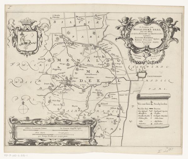
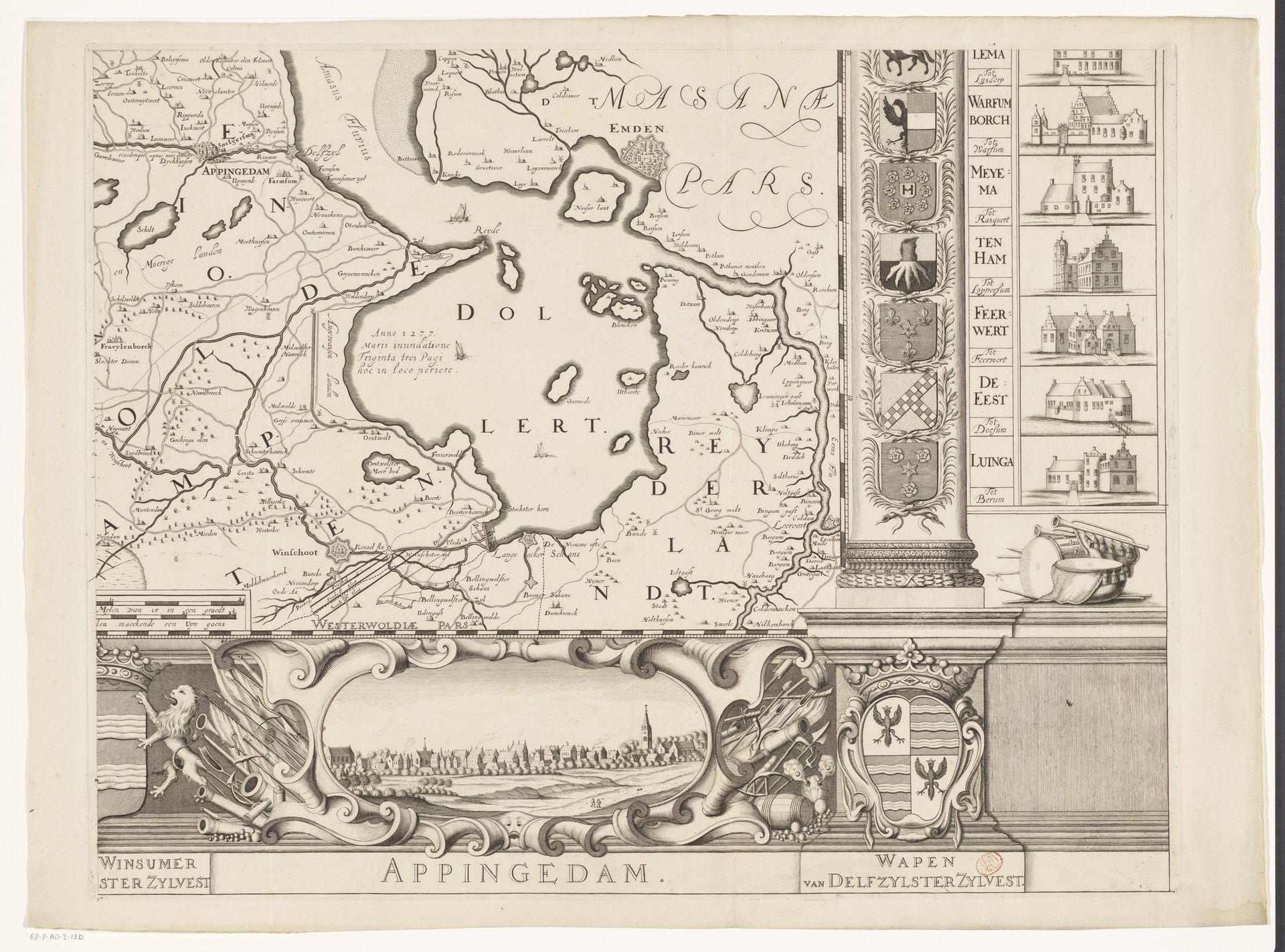
This is a section of a map of the province of Groningen, made by Cornelis Apeus. Here, symbols tell a silent story of power and place. Notice the heraldic shields, each bearing unique emblems. The horse, the star, the fleur-de-lis: these aren't mere decorations. They are visual anchors to identity, announcing the lineage and authority of noble families and towns. Coats of arms like these are emblems of collective memory and identity, deeply connected to familial and communal pride. These are repeated gestures that echo across Europe and throughout history. Consider the lion rampant, a fierce emblem of courage, appearing since antiquity. It's a primal symbol, tapping into our subconscious associations of strength and dominion. The presence of these symbols evokes an emotional response, engaging viewers on a deep, often subconscious level. Such symbols are not static; they evolve, adapt, and resurface, carrying echoes of the past into the present.
Artwork details
- Medium
- drawing, print, ink, engraving
- Dimensions
- height 533 mm, width 678 mm
- Copyright
- Rijks Museum: Open Domain
Tags
Comments
Share your thoughts
About this artwork
This is a section of a map of the province of Groningen, made by Cornelis Apeus. Here, symbols tell a silent story of power and place. Notice the heraldic shields, each bearing unique emblems. The horse, the star, the fleur-de-lis: these aren't mere decorations. They are visual anchors to identity, announcing the lineage and authority of noble families and towns. Coats of arms like these are emblems of collective memory and identity, deeply connected to familial and communal pride. These are repeated gestures that echo across Europe and throughout history. Consider the lion rampant, a fierce emblem of courage, appearing since antiquity. It's a primal symbol, tapping into our subconscious associations of strength and dominion. The presence of these symbols evokes an emotional response, engaging viewers on a deep, often subconscious level. Such symbols are not static; they evolve, adapt, and resurface, carrying echoes of the past into the present.
Comments
Share your thoughts