drawing, print, etching, ink, engraving
#
pen and ink
#
drawing
#
pen drawing
# print
#
pen sketch
#
etching
#
old engraving style
#
landscape
#
etching
#
ink
#
geometric
#
orientalism
#
academic-art
#
engraving
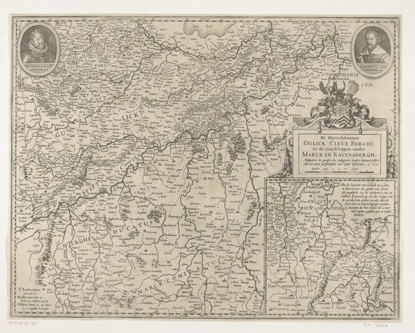
Dimensions: height 519 mm, width 725 mm
Copyright: Rijks Museum: Open Domain
Jodocus Hondius created this map of the province of Utrecht sometime around the turn of the 17th century, using engraving techniques. Hondius was a Flemish artist, engraver, and cartographer whose life was marked by religious persecution and displacement. During his lifetime, maps were not just geographical tools but also powerful statements of ownership and identity, especially in a region undergoing constant political and religious upheaval. Think of this map as more than an objective document; it's a cultural artifact reflecting the complex relationship between people and their land. Consider how elements like decorative cartouches and compass roses might have served to assert Dutch identity and commercial prowess. As you look at it, reflect on what it means to chart, to claim, and to represent a territory. Notice how the detailed rendering of cities and waterways emphasizes the province's economic and strategic importance. How might this map have shaped the perception of Utrecht, both for those who lived there and those who sought to control it?
Comments
No comments
Be the first to comment and join the conversation on the ultimate creative platform.
More like this