drawing, paper, ink
#
drawing
#
toned paper
#
pen sketch
#
landscape
#
river
#
paper
#
ink
#
ink drawing experimentation
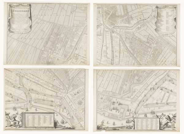
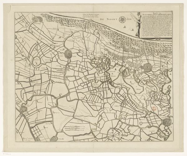
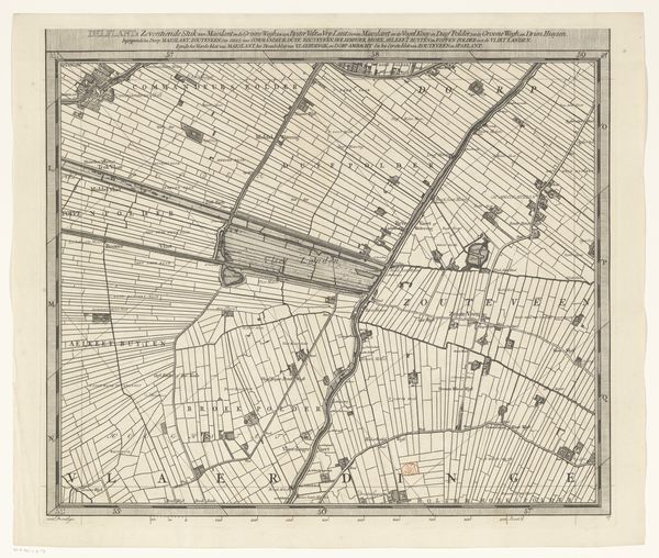
Dimensions: height 557 mm, width 1276 mm
Copyright: Rijks Museum: Open Domain
Editor: This is David Coster's "Kaart van de Merwede, bestaande uit twee delen," created around 1730, using ink on paper. What strikes me is the precision, the way it tries to capture an entire landscape in these almost architectural lines. What do you make of this work? Curator: This map isn't just about geographical accuracy; it’s a representation of power, of human intervention on the landscape. See how the river, the Merwede, dominates, almost a vein connecting these meticulously planned land divisions? Each of those lines signifies ownership, control, an attempt to tame nature. Editor: So it's about more than just seeing; it's about possessing? Curator: Exactly. Maps in this era were powerful symbols of dominion. Think of the symbolic weight of water, its life-giving force, now neatly charted and, implicitly, controlled. And consider how the visual language of these "architectural lines," as you described them, echoes the language of legal documents and land deeds. The symbols carry that weight. Do you see any points of tension, or contradiction? Editor: I see the imposing river running wild on the sides of each paper. Could that contrast tell a story? Curator: Precisely! That tension between the impulse to control, represented by all the straight lines and boxes, and the inherent wildness of the river. It’s the eternal push-and-pull between humanity and nature etched in ink. Perhaps Coster is subtly acknowledging nature's indomitable spirit? Editor: That's fascinating. I hadn't considered how much cultural information could be encoded in what seems like a straightforward map. Curator: Indeed. By understanding the symbolic language, we see that the map does not simply portray but actually performs a cultural role. A dialogue that echoes through time.
Comments
No comments
Be the first to comment and join the conversation on the ultimate creative platform.
More like this