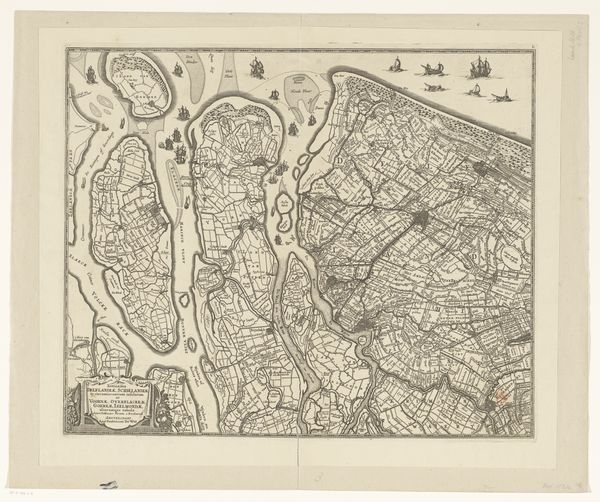
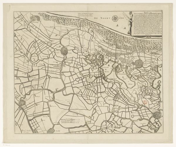
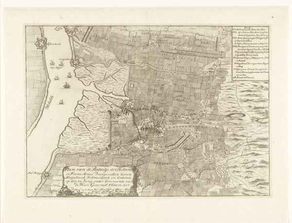
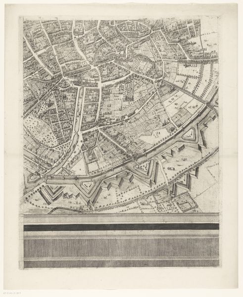
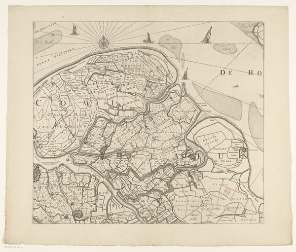
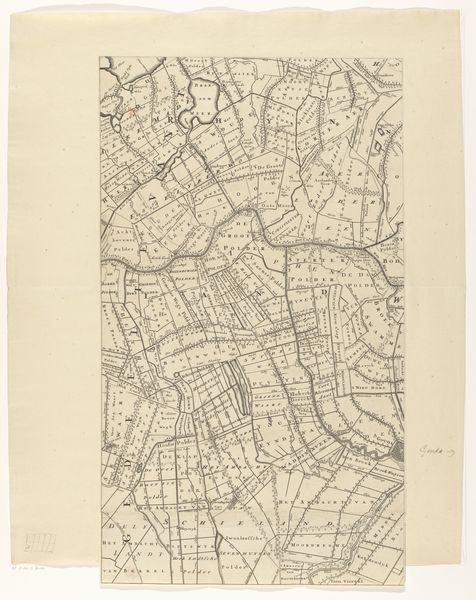
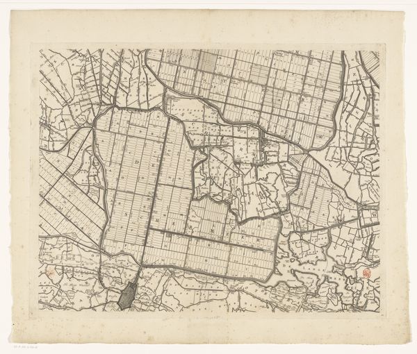
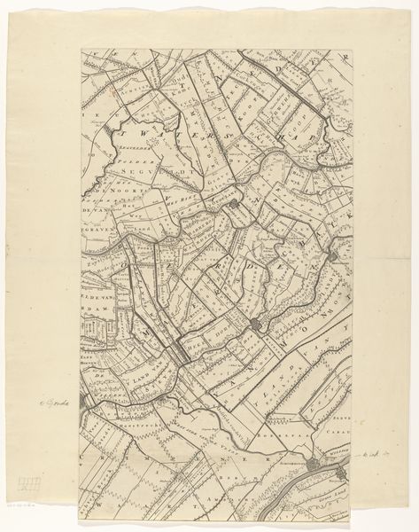
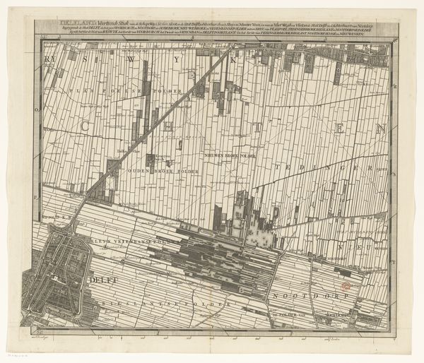
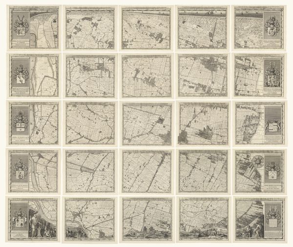
Kaart van het Hoogheemraadschap van Delfland, bestaande uit negen delen 1611 - 1692
0:00
0:00
florisbalthasarszvanberckenrode
Rijksmuseum
#
aged paper
#
pen sketch
#
old engraving style
#
hand drawn type
#
personal sketchbook
#
sketchwork
#
pen-ink sketch
#
pen work
#
sketchbook drawing
#
sketchbook art
Dimensions: height 992 mm, width 925 mm
Copyright: Rijks Museum: Open Domain
This is Floris van Berckenrode's detailed map of Delfland, created around the turn of the 17th century. It is made of nine parts and offers a meticulous view into the geographical and administrative landscape of the region. Cartography in the Dutch Golden Age was deeply intertwined with commerce, colonialism, and control. Maps were not just representations of land, but tools of power. Berckenrode's map reflects the intense human intervention in the Dutch landscape, particularly in water management. Note, for instance, how the waterways are geometrically organized. The map is a document of human interaction with the environment, reflecting the social and economic structures of the time. Who benefits from this controlled landscape? Whose labor built and maintained these systems? These are critical questions to consider when we look at this beautiful, yet complex, depiction of land and power. It serves as a reminder of the complex relationship between people, place, and power.
Comments
No comments
Be the first to comment and join the conversation on the ultimate creative platform.
More like this