drawing, print, etching, paper, engraving
#
drawing
#
baroque
# print
#
etching
#
etching
#
paper
#
geometric
#
cityscape
#
engraving
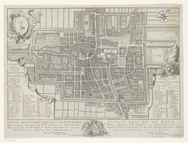
Dimensions: height 459 mm, width 582 mm
Copyright: Rijks Museum: Open Domain
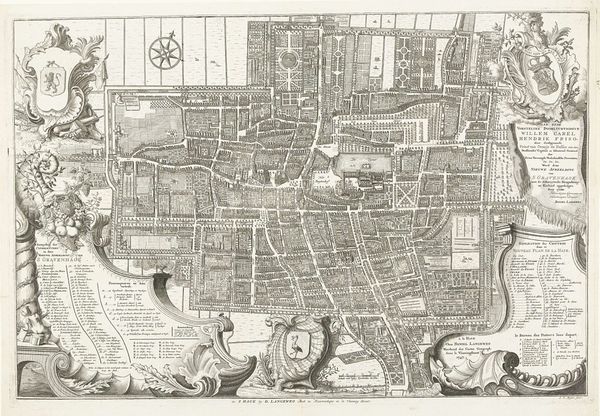
This is an anonymous map of The Hague, dating from 1729. The image strikes you with its intricate detail, a dense network of lines and geometric shapes forming the city's layout. Visually, the map is structured around a grid, imposing an order onto the urban space. This grid, a symbol of rationality, reflects a broader cultural desire to control and understand the world through structured systems. Each block is meticulously rendered, highlighting not just the buildings but also the gardens and waterways, suggesting an integration of nature into the city's design. The map employs a semiotic language, using specific symbols to denote key locations and features, inviting us to decode the city's social and political landscape. What is interesting is how the grid challenges the organic, chaotic nature of urban life, imposing a structured meaning onto the city. This interplay between order and chaos, representation and reality, reveals a tension inherent in the act of mapping. Notice how the formal quality of the map, its ordered composition and detailed rendering, functions as a cultural and philosophical statement about how we perceive and represent our world.
Comments
No comments
Be the first to comment and join the conversation on the ultimate creative platform.
More like this