About this artwork
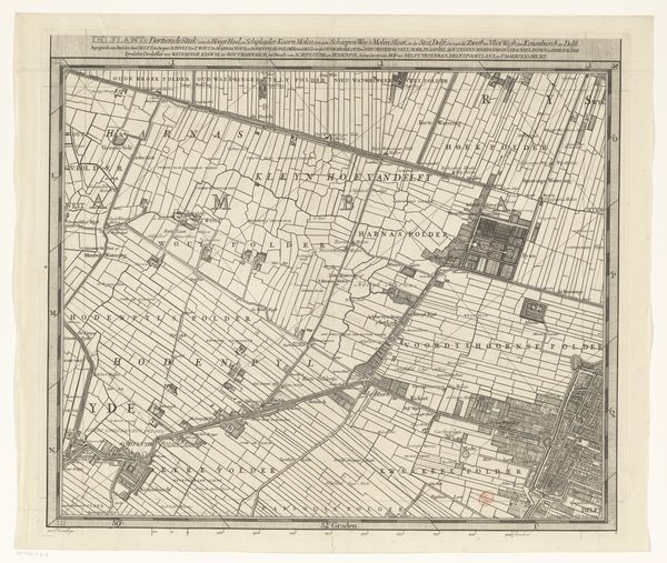
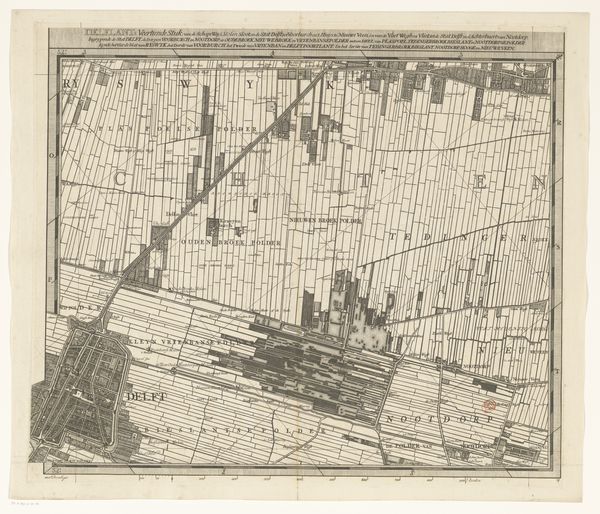
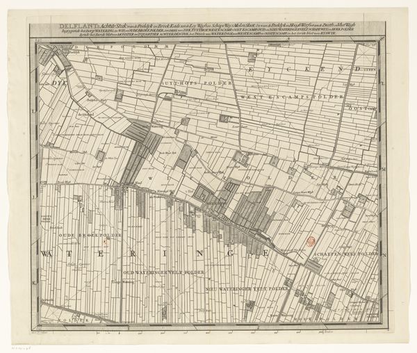
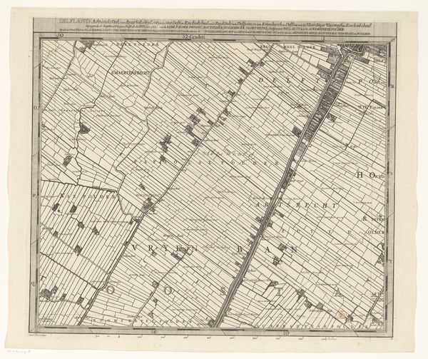
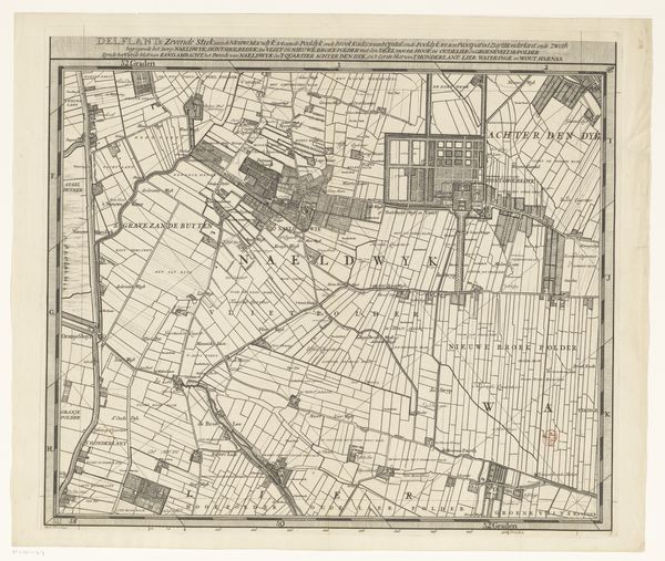
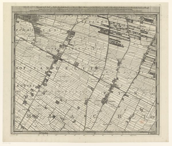
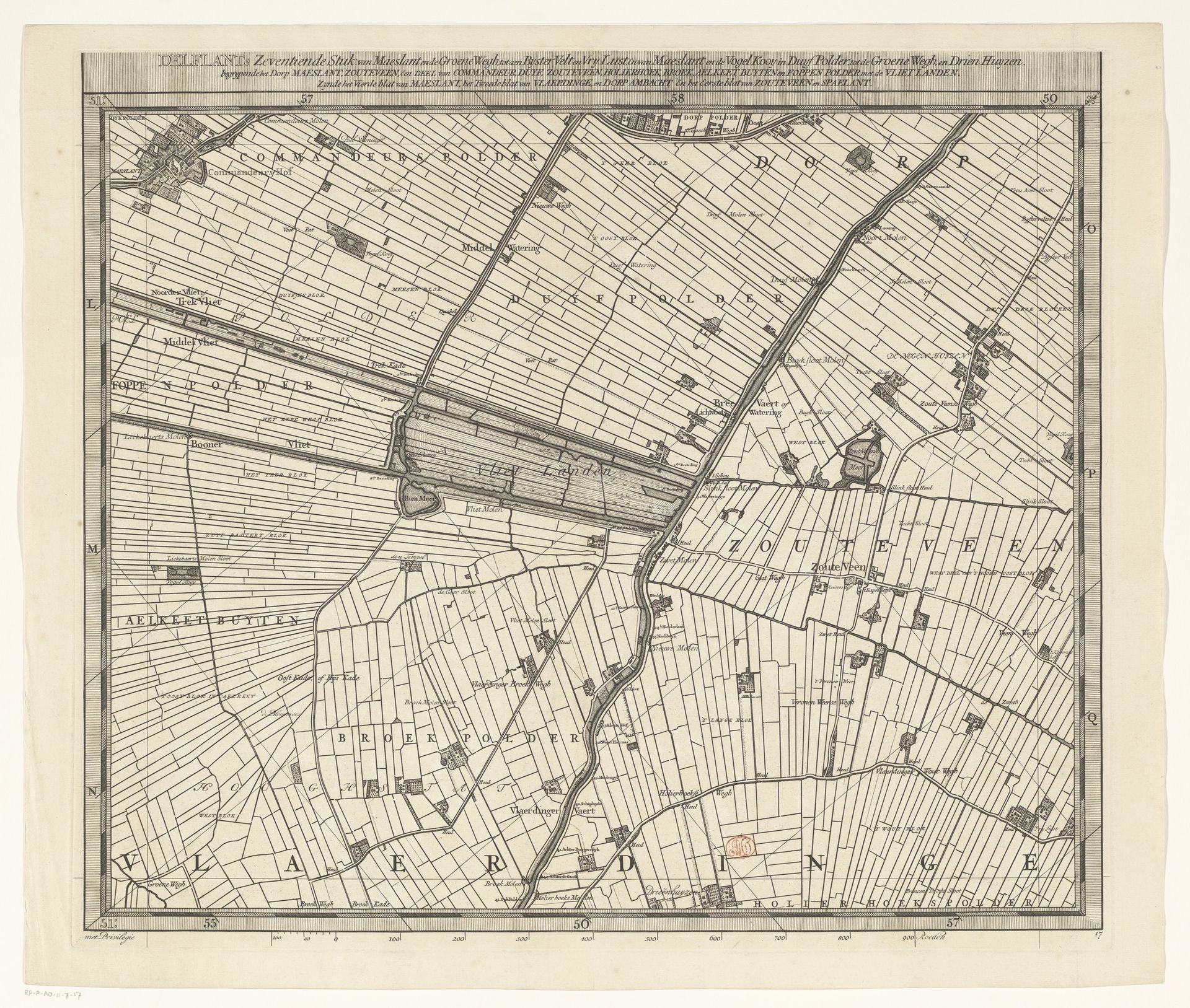
Luggert van Anse made this segment of a map of Delfland, using engraving. The detailed rendering of polders, waterways, and land divisions offers insight into the human alterations of the Dutch landscape. The map evokes the socio-economic dynamics intrinsic to land use. Delfland, as a region, embodies the story of Dutch hydraulic engineering. It is a place where land was reclaimed and managed. The organization of space, as depicted by van Anse, reflects the deeply rooted connection between the people and their environment. The disciplined lines of the polders represent the ongoing negotiation between nature and human settlement. The map transforms the region into a display of power. It serves not only as a geographical tool but as a symbol of control and authority over the land. It subtly alludes to the ecological and societal impacts of intensive land management.
Kaart van het Hoogheemraadschap van Delfland (zeventiende deel) 1712 - 1735
Artwork details
- Medium
- print, etching, engraving
- Dimensions
- height 513 mm, width 592 mm
- Copyright
- Rijks Museum: Open Domain
Tags
aged paper
dutch-golden-age
etching
old engraving style
landscape
etching
engraving
Comments
No comments
About this artwork
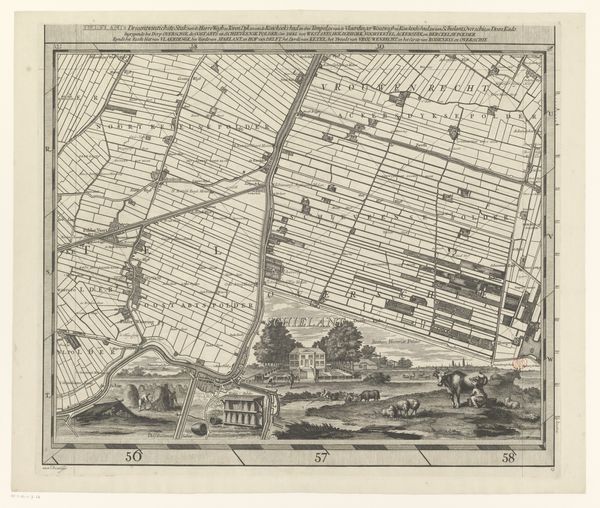
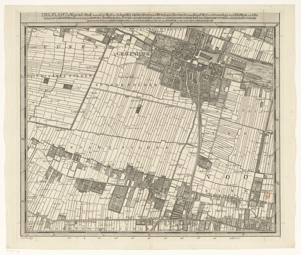
Luggert van Anse made this segment of a map of Delfland, using engraving. The detailed rendering of polders, waterways, and land divisions offers insight into the human alterations of the Dutch landscape. The map evokes the socio-economic dynamics intrinsic to land use. Delfland, as a region, embodies the story of Dutch hydraulic engineering. It is a place where land was reclaimed and managed. The organization of space, as depicted by van Anse, reflects the deeply rooted connection between the people and their environment. The disciplined lines of the polders represent the ongoing negotiation between nature and human settlement. The map transforms the region into a display of power. It serves not only as a geographical tool but as a symbol of control and authority over the land. It subtly alludes to the ecological and societal impacts of intensive land management.
Comments
No comments