print, etching
# print
#
etching
#
etching
#
geometric
#
cityscape
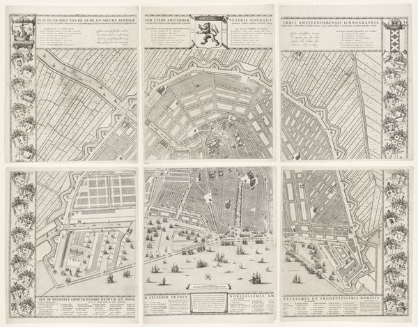
Dimensions: height 1310 mm, width 1755 mm
Copyright: Rijks Museum: Open Domain
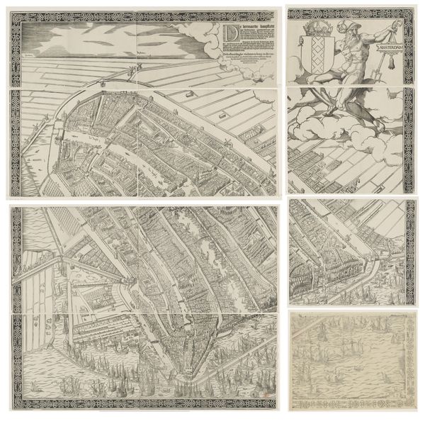
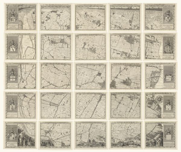
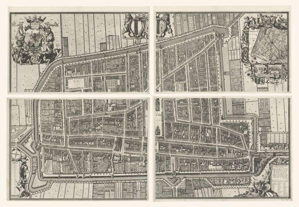
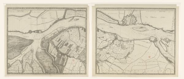
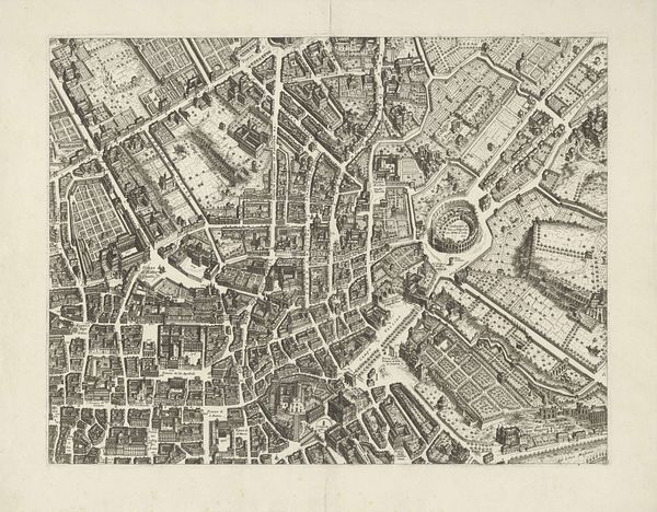
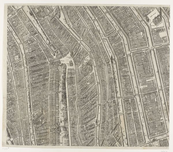
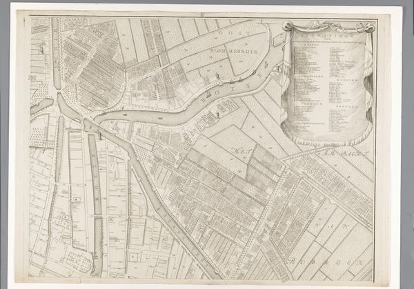
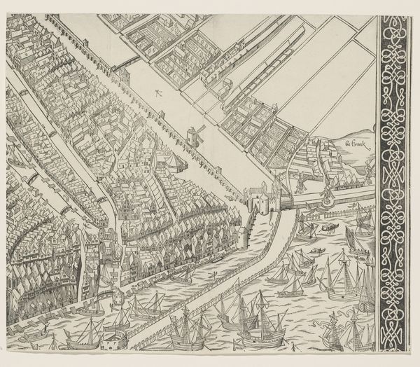
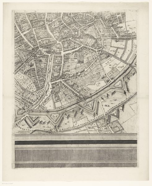
Cornelis van Baarsel created this map of Rotterdam in four parts, with each section meticulously rendered in detailed line work. The monochromatic palette emphasizes the structural clarity of the city's layout, offering a comprehensive view of its urban organization. The map presents a fascinating interplay of order and complexity. The grid-like structure of the streets and waterways contrasts with the organic forms of the landscape, highlighting the intersection of human design and natural environment. We can see how the cartographer imposes a rational framework to represent the dynamic reality of the city. It can be thought that this representation extends beyond mere documentation, reflecting the Enlightenment's emphasis on reason, order, and classification. The map becomes a semiotic device, where each line, symbol, and label serves as a signifier within a larger system of urban representation. The city's formal design reveals the broader intellectual currents shaping society. As such, this map is not just an aesthetic object, but a cultural artifact deeply embedded in its time.
Comments
No comments
Be the first to comment and join the conversation on the ultimate creative platform.
More like this