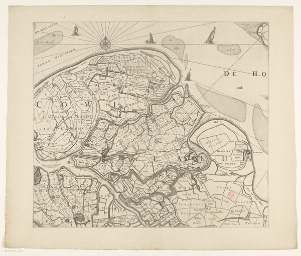
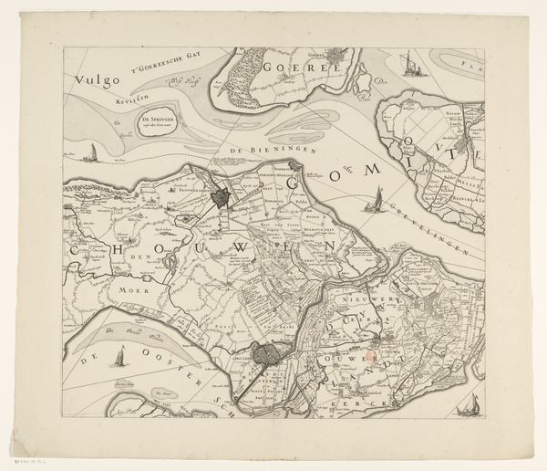
Historische kaart van een deel van Zuid- en Noord-Holland 1644 - 1724
0:00
0:00
claesjanszvisscher
Rijksmuseum
drawing, print, etching, ink
#
drawing
#
dutch-golden-age
# print
#
etching
#
etching
#
ink line art
#
ink
#
cityscape
Dimensions: height 482 mm, width 584 mm
Copyright: Rijks Museum: Open Domain
Editor: This is an etching titled "Historische kaart van een deel van Zuid- en Noord-Holland" - or "Historical Map of Part of South and North Holland" - made with ink on paper, sometime between 1644 and 1724 by Claes Jansz Visscher. The intricate network of lines is mesmerizing, like a visual puzzle of land and water. How do you interpret the formal structure of this map as a work of art? Curator: Indeed. Let us consider the deployment of line. Observe the unwavering precision with which Visscher delineates the contours of the land, creating a tapestry of geometric forms. Do you notice the varying weights and densities? These are not merely representational but articulate a visual hierarchy. Note the subtle variations suggesting depth and volume, achieved purely through tonal gradations of ink. The composition eschews traditional perspective in favor of a flattened, schematic view. Why do you think Visscher made this choice? Editor: Perhaps to prioritize information over realistic depiction, making it more functional as a map? But the artistry is still apparent. The delicate hatching and the stylized rendering of the landscape elements—the trees, the buildings— elevates it. It's more than just information; it’s a considered visual statement. Curator: Precisely. And it is vital we note the dialectic between the objective, cartographic function, and the subjective aesthetic rendering. The network of lines forms an almost abstract composition. Its interplay evokes the interplay between representation and abstraction itself, forcing a critical examination of how we perceive the world. What implications do you perceive for subsequent art movements which favored abstraction? Editor: It pushes me to reconsider how even functional objects can possess significant artistic merit, how the lines create both representation and abstract beauty. Thank you for the incisive analysis. Curator: The pleasure was mine. Such cartographic works illustrate perfectly that all forms are artifice, structures contingent to ideology and perspective.
Comments
No comments
Be the first to comment and join the conversation on the ultimate creative platform.
More like this